Bulletins
Comprehensive reports on a single scientific topic synthesizing significant data and interpretations of lasting scientific interest.
Where are the map plates? If a multipart publication is downloadable as a single PDF, map plates are bundled with the report. Scroll to the end of the report to find the map plates.
| No. | Year | Format | Details | Thumbnail |
|---|---|---|---|---|
| B-108 | 2021 | preview / download zip file 123 MB) |
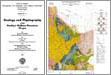
Geology of the North Half of the Lower Crooked River Basin, Crook, Deschutes, Jefferson, and Wheeler Counties, Oregon, by Jason D. McClaughry, Mark L. Ferns, and Caroline L. Gordon; 286 p. report; 1 map plate, scale 1:63,360; Esri format geodatabase; shapefiles; metadata; spreadsheets. |  |
| B-107 | 2010 | preview / download zip file 123 MB) |
Geology of the upper Grande Ronde River basin, Union County, Oregon, by Mark L. Ferns, Vicki S. McConnell, Ian p. Madin, and Jenda A. Johnson, 2010, 65 p., 1 pl., scale: 1:100,000 .Includes data files in .shp, .dbf, and .xls formats. |  |
| B-106 | n/a | n/a | Selected bulletins published between 1971 and 1987 [compilation CD contained Bulletins 70, 71, 73, 76, 78, 86, 92, 96, 97, 101, 102, and 103], 2003. | |
| B-105 | n/a | n/a | Selected bulletins published between 1950 and 1970 [compilation CD contained Bulletins 42, 43, 44, 45, 47, 48, 50, 51, 53, 54, 56, 57, 59, 62, 63, 65, 67, and 68], 2003. | |
| B-104 | n/a | n/a | Selected bulletins published between 1937 and 1949 [compilation CD contained Bulletins 1, 2, 4, 5, 6, 7, 8, 9, 10, 11, 13, 16, 17, 18, 19, 20, 21, 23, 24, 25, 26, 28, 30, 32, 33, 38, and 41], 2003. | |
| B-103 | 1987 | Bibliography of the geology and mineral resources of Oregon: Eighth Supplement, January 1, 1980, to December 31, 1984, by Klaus K.E. Neuendorf, ed., and compiled and indexed by GeoRef Information System, Kay Yost, ed., 1987, 176 p. |  |
|
| B-102 | 1981 | Bibliography of the geology and mineral resources of Oregon, January 1, 1976 to December 31, 1979, compiled by GeoRef Information System, and Debbie Burnetti and Klaus Neuendorf, eds., 1981, 68 p. |  |
|
| B-101 | 1980 | Geologic field trips in western Oregon and southwestern Washington, by Keith F. Oles, J. Granville Johnson, Alan R. Niem, and Wendy A Niem, eds. Alan R. Niem, Wendy A. Niem, Edward M. Taylor, and Herbert G. Schlicker, Field Trip Committee Co-chairmen, 1980, 232 p. |  |
|
| B-100 | 1979 | Geology and mineral resources of Josephine County, Oregon, by Len Ramp and Norman V. Peterson, 1979, 45 p., 4 pl., scale: Plate 1, 1:62,500; Plate 2, 1:62,500; Plate 3.1, 1:62,500; Plate 3.2, 1:31,680. |  |
|
| B-99 | 1979 | Geology and geologic hazards of northwestern Clackamas County, Oregon, by Herbert G. Schlicker and C. T. Finlayson, 1979, 79 p., 10 pl., scale: 1:24,000. |  |
|
| B-98 | 1979 | PDF (103 MB) | Geologic hazards of eastern Benton County, Oregon, by James L. Bela, 1979, 122 p., 5 pl., scale: 1:24,000. |  |
| B-97 | 1978 | Bibliography of the geology and mineral resources of Oregon: Seventh supplement, January 1, 1971 to December 31, 1975, compiled by GeoRef, with the assistance of Ainslie Bricker, edited by Caroline p. R. Hulick, 1978, 74 p. | ||
| B-96 | 1977 | Magma genesis, 1977: Proceedings of the American Geophysical Union Chapman Conference on partial melting in the Earth's upper mantle, by Henry J. B. Dick, ed.; Sandra Tonge, ed. asst.; Henry J. B. Dick, L.G. Medaris Jr., M. Menzies, B. O. Mysen, M.J. O'Hara and Len Ramp, organizing committee, 1977, 311 p. |  |
|
| B-95 | 1977 | North American ophiolites, by R. G. Coleman and W. Irwin (eds.), 1977, 183 p., 5 pl., scale: Plate 1, 1:7,042,253.5; Plate 2, 1:487,804.8; Plate 3, 1:3,448,275.8; Plate 4, 1:73,728; Plate 5, 1:319,149. |  |
|
| B-94 | 1977 | Land use geology of central Jackson County, Oregon, by John D. Beaulieu and Paul W. Hughes, 1977, 87 p., 10 pl., scale: 1:62,500. |  |
|
| B-93 | 1977 | Geology, mineral resources, and rock material of Curry County, Oregon, by Len Ramp, Herbert G. Schlicker, and Jerry J. Gray, 1977, 79 p., 3 pl., scale: Plate 1, 1:125,000; Plate 2, 1:126,720; Plate 3, 1:31,680. |  |
|
| B-92 | 1977 | Fossils in Oregon: A collection of reprints from the Ore Bin, by Margaret L. Steere, ed., 1977, 227 p. | ||
| B-91 | 1977 | Geologic hazards of parts of northern Hood River, Wasco, and Sherman Counties, Oregon, by John D. Beaulieu, 1977, 95 p., 11 pl., scale: Geologic maps, 1:62,500; Geologic Hazards maps, 1 62,500; Geologic Hazards map of The Dalles and vicinity, 1:24,252. |  |
|
| B-90 | 1976 | Land-use geology of western Curry County, Oregon, by John D. Beaulieu and Paul W. Hughes, 1976, 148 p., 12 pl., scale: 1:62,500. |  |
|
| B-89 | 1976 | Geology and mineral resources of Deschutes County, Oregon, by Norman V. Peterson, Edward A . Groh, Edward M. Taylor and Donald E. Stensland, 1976, 66 p., 4 pl., scale: Geologic map of the Redmond area, 1:24,000; Geologic map of the Bend area, 1:24,000; Geologic compilation map, 1:94,953; Mineral location map, 1:94,953. |  |
|
| B-88 | 1975 | Geology and mineral resources of the upper Chetco drainage area, Oregon, including the Kalmiopsis Wilderness and Big Craggies botanical areas, by Len Ramp, 1975, 47 p., 2 pl., scale: 1:48,000. |  |
|
| B-87 | 1975 | Environmental geology of western Coos and Douglas Counties, Oregon, by John D. Beaulieu and Paul W. Hughes, 1975, 148 p., 16 pl., scale: 1:62,500. |  |
|
| B-86 | 1974 | Nineteenth biennial report of the State of Oregon Department of Geology and Mineral Industries, 1972-1974, by R. W. deWeese, William E. Miller and H. Lyle Van Gordon, 1974, 23 p. |  |
|
| B-85 | 1974 | Environmental geology of coastal Lane County, Oregon, by Herbert G. Schlicker, Robert J. Deacon, R. C. Newcomb and R. L. Jackson, 1974, 116 p., 3 pl., scale: Environmental Geologic map, 1:62,500; Geologic Hazards map, 1:62,500; Soils map, 1:30,720. |  |
|
| B-84 | 1974 | Environmental geology of western Linn County, Oregon, by John D. Beaulieu, Paul W. Hughes and Kent Mathiot, 1974, 117 p., 22 pl., scale: 1:62,500. |  |
|
| B-83 | 1974 | Eocene stratigraphy of southwestern Oregon, by Ewart M. Baldwin, 1974, 40 p., 1 pl., scale: 1:250,000. |  |
|
| B-82 | 1974 | Geologic hazards of the Bull Run watershed, Multnomah and Clackamas Counties, Oregon, by John D. Beaulieu, 1974, 77 p., 2 pl., scale: 1:31,680. |  |
|
| B-81 | 1973 | Environmental geology of Lincoln County, Oregon, by Herbert G. Schlicker, Robert J. Deacon, Gordon W. Olcott and John D. Beaulieu, 1973, 171 p., 6 pl., scale: 1:62,500. |  |
|
| B-80 | 1973 | Geology and mineral resources of Coos County, Oregon, by Ewart M. Baldwin, John D. Beaulieu, Len Ramp, Jerry J. Gray, Vernon C. Newton and Ralph S. Mason, 1973, 82 p., 4 .pl., scale: Plate 1, 1:62,500; Plate 2, 1:62,500; Plate 3, 1:62,500; Plate 4, 1:225,280. |  |
|
| B-79 | 1973 | Environmental geology of inland Tillamook and Clatsop Counties, Oregon, by John D. Beaulieu, 1973, 65 p., 14 pl., scale: 1:62,500. |  |
|
| B-78 | 1973 | Bibliography of the Geology and mineral resources of Oregon: Fifth Supplement, January 1, 1961 to December 31, 1970, compiled by Miriam S. Roberts, Margaret L. Steere and Caroline S. Brookhyser, 1973, 199 p. |  |
|
| B-77 | 1973 | Geologic field trips in northern Oregon and southern Washington, by John D. Beaulieu, 1973, 206 p., 3 pl., scale: 1:300,000. |  |
|
| B-76 | 1972 | Eighteenth biennial report of the State Department of Geology and Mineral Industries of the State of Oregon, 1970-1972, by R. W. deWeese, William E. Miller and Donald G. McGregor, 1972, 19 p. |  |
|
| B-75 | 1972 | Geology and mineral resources of Douglas County, Oregon, by Len Ramp, 1972, 106 p., 1 pl., scale: 1:250,000. |  |
|
| B-74 | 1972 | .zip (284 MB) |
Environmental geology of the coastal region of Tillamook and Clatsop counties, Oregon, by Herbert G. Schlicker, Robert J. Deacon, John D. Beaulieu, and Gordon W. Olcott, 1972, 164 p., 18 pl., scale: 1:62,500 (engineering geologic, geologic hazard, slope maps for each of six quadrangles: Astoria, Cannon Beach, Hebo, Nehalem, Svensen, Tillamook). |  |
| B-73 | 1972 | Geologic formations of eastern Oregon (east of longitude 121 degrees 30 minutes), by John D. Beaulieu, 1972, 80 p. |  |
|
| B-72 | 1971 | Bedrock geology of the Mitchell quadrangle, Wheeler County, Oregon, by Keith F. Oles and Harold E. Enlows, 1971, 62 p., 1 pl., scale: 1:48,000. |  |
|
| B-71 | 1971 | Geology of selected lava tubes in the Bend area, Oregon, by Ronald Greeley, 1971, 47 p., 3 pl., scale: Plate 1, 1:24,000; Plate 2, 1:32,000; Plate 3, 1:168,960. |  |
|
| B-70 | 1971 | Geologic formations of western Oregon, by John D. Beaulieu, 1971, 72 p. |  |
|
| B-69 | 1971 | Geology of the southwestern Oregon coast west of the 124th Meridian, by R. H. Dott, Jr., 1971, 63 p., 2 pl., scale: Plate 1, 1:250,000; Plate 2, 1:62,500. |  |
|
| B-68 | 1970 | PDF (85 MB PDF) | Seventeenth biennial report of the State Department of Geology and Mineral Industries of the State of Oregon, 1968-1970, by Fayette I. Bristol, R. W. deWeese and Harold Banta, 1970, 45 p. |  |
| B-67 | 1970 | Bibliography of the Geology and mineral resources of Oregon: Fourth Supplement, January 1, 1956 to December 31, 1960, by Miriam Roberts, 1970, 88 p. |  |
|
| B-66 | 1970 | PDF (83 MB PDF) | The reconnaissance geology and mineral resources of eastern Klamath County and western Lake County, Oregon, by Norman V. Peterson and James R. McIntyre, 1970, 70 p., 2 pl., scale: 1:250,000. |  |
| B-65 | 1969 | Proceedings of the Andesite Conference, by Alexander R. McBirney, ed., 1969, 193 p. |  |
|
| B-64 | 1969 | Mineral and water resources of Oregon, by A. E. Weissenhorn, ed., 1969, 462 p., 1 pl., scale: 1:1,900,800. |  |
|
| B-63 | 1968 | Sixteenth biennial report of the State Department of Geology and Mineral Industries of the State of Oregon, 1966-1968, by Frank C. McColloch, Harold Banta and Fayette I. Bristol, 1968, 35 p. | ||
| B-62 | 1968 | Andesite Conference Guidebook, by Hollis M. Dole and Cornelius J. Newhouse, 1968, 107 p. |  |
|
| B-61 | 1968 | Gold and silver in Oregon, by Howard C. Brooks and Len Ramp, 1968, 337 p., 4 pl., scale: Plate 1, 1:1,745.45; Plate 2, 1:1,440; Plate 3, 1:25,664.8; Figure 35, 1:250,000. |  |
|
| B-60 | 1967 | Engineering geology of the Tualatin Valley region, Oregon, by Herbert G. Schlicker, Robert J. Deacon and Cornelius J. Newhouse, 1967, 103 p., 4 pl., scale: Plate 1, 1:4,800; Plate 2, 1:4,800; Plate 3, 1:4,800; Plate 4, 1:4,800. |  |
|
| B-59 | 1967 | Fifteenth biennial report of the State Department of Geology and Mineral Industries of the State of Oregon, 1964-1966, by Frank C. McColloch, Harold Banta and Fayette I. Bristol, 1967, 27 p. |  |
|
| B-58 | 1965 | Geology of the Suplee-Izee area: Crook, Grant, and Harney Counties, Oregon, by William R. Dickinson and Lawrence W. Vigrass, 1965, 109 p., 3 pl., scale: 1:42,240; 1:63,360; 1:63,360. |  |
|
| B-57 | 1965 | State of Oregon Lunar Geological Field Conference Guide Book, by Norman V. Peterson, Edward A. Groh and C. J. Newhouse, 1965, 51 p. |  |
|
| B-56 | 1965 | Fourteenth biennial report of the State Geologist, 1962-1964, by Frank C. McColloch, Harold Banta and Fayette I. Bristol, 1965, 33 p. |  |
|
| B-55 | 1963 | Quicksilver in Oregon, by Howard C. Brooks, 1963, 223 p., 8 pl., scale: Plate 1, 1:1,013,760; Plate 3, 1:960; Plate 4, 1:1,600; Plate 5-1, 1:3,490.9; Plate 5-2, 1:2,400; Plate 5-3, 1:738.4; Plate 6-1, 1:1,280; Plate 6-2, 1:1,371.4; Plate 6-3, 1:4,608,000; Plate 8, 1:1,371.4. |  |
|
| B-54 | 1963 | Thirteenth biennial report of the State Department of Geology and Mineral Industries of the State of Oregon, 1960-1962, by Frank C. McColloch, Harold Banta and Fayette I. Bristol, 1963, 16 p. |  |
|
| B-53 | 1962 | Bibliography of the Geology and mineral resources of Oregon: Third Supplement, January 1, 1951 to December 31, 1955, compiled by Margaret L. Steere and Lillian F. Owen, 1962, 97 p. |  |
|
| B-52 | 1961 | Chromite in southwestern Oregon, by Len Ramp, 1961, 169 p., 3 pl., scale: Plate 1-1:281,600; Plate 9-1:240; Plate 10-1:24,526. | 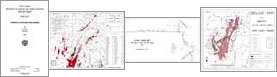 |
|
| B-51 | 1960 | Twelfth biennial report of the State Department of Geology and Mineral Industries of the State of Oregon, 1958-1960, by William Kennedy, Harold Banta and Earl S. Mollard, 1960, 13 p. |  |
|
| B-50 | 1959 | Field guidebook: geologic trips along Oregon highways, by W. D. Wilkinson, 1959, 148 p. | ||
| B-49 | 1959 | Lode mines of the central part of the Granite mining district, Grant County, Oregon, by George S. Koch, Jr., 1959, 49 p., 4 pl., scale: Figure 7, 1:3,840; Figure 10, 1:1,200; Figure 11, 1:1,200; Figure 23, 1:1,200. | 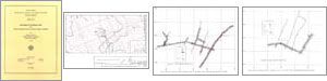 |
|
| B-48 | 1958 | Eleventh biennial report, State of Oregon, Department of Geology and Mineral Industries, 1956-1958, by William Kennedy, Les Child, and Nadie Strayer, 1958, 35 p. |  |
|
| B-47 | 1956 | Tenth biennial report of the State Department of Geology and Mineral Industries of the State of Oregon, 1954-1956, by Mason L. Bingham, Niel R. Allen, and Austin Dunn, 1956, 38 p. | ||
| B-46 | 1956 | Ferruginous bauxite deposits in the Salem Hills, Marion County, Oregon, by Raymond E. Corcoran and F.W. Libbey, 1956, 53 p., scale: Plate 1, 1:42,240; Plate 2, 1:7,200 |  |
|
| B-45 | 1954 | Ninth biennial report of the State Department of Geology and Mineral Industries of the State of Oregon, 1952-1954, by Mason L. Bingham, Niel R. Allen, and Austin Dunn, 1954, 27 p. |  |
|
| B-44 | 1953 | Bibliography of the Geology and mineral resources of Oregon: Second Supplement, January 1, 1946 to December 31, 1950, by Margaret L. Steere, 1953, 61 p. |  |
|
| B-43 | 1952 | Eighth biennial report of the State Department of Geology and Mineral Industries of the State of Oregon, 1950-1952, by Mason L. Bingham, H. E. Hendryx, and Niel R. Allen, 1952, 23 p. |  |
|
| B-42 | 1950 | Seventh biennial report of the State Department of Geology and Mineral Industries of the State of Oregon, 1948-1950, by Niel R. Allen, H. E. Hendryx, and Mason L. Bingham, 1950, 25 p. |  |
|
| B-41 | 1949 | Ground-water studies in Umatilla and Morrow Counties, by Norman S. Wagner, 1949, 100 p., 1, scale: 1:506,880. | ||
| B-40 | 1949 | Preliminary description of the geology of the Kerby quadrangle, Oregon, by Francis G. Wells, Preston E. Hotz, and Fred W. Cater, Jr., 1949, 23 p., 1 pl., scale: 1:96,000. | 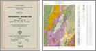 |
|
| B-39 | 1948 | Geology and mineralization of the Morning Mine and adjacent region, Grant County, Oregon, by Rhesa M. Allen, Jr., 1948, 44 p., 1 pl., scale: 1:62,500. | 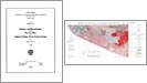 |
|
| B-38 | 1948 | Sixth biennial report of the State Department of Geology and Mineral Industries of the State of Oregon, 1946-1948, by Niel R. Allen, E.B. MacNaughton, and H. E. Hendryx, 1948, 49 p. |  |
|
| B-37 | 1953 | Geology of the Albany quadrangle, Oregon, by Ira S. Allison, 1953, 18 p., 1 pl., scale: 1:62,500. | 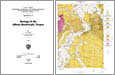 |
|
| B-36 | 1947 | Vol. 1: PDF
|
Papers on foraminifera from the Tertiary of western Oregon, by Joseph A. Cushman, Roscoe E. Stewart, and Katherina C. Stewart, 1947. Vol 1, 110 p.:
Vol. 2, 208 p.:
|
 |
| B-35 | 1947 | Geology of the Dallas and Valsetz quadrangles, Oregon, by Ewart M. Baldwin, 1947, text rev. 1964, 56 p., 3 pl., Dallas quadrangle, 1:62,500; Valsetz quadrangle, 1:62,500; Plate 4, 1:2,400. | 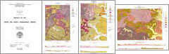 |
|
| B-34 | 1947 | Mines and prospects of the Mount Reuben mining district, Josephine County, Oregon, by Elton A. Youngberg, 1947, 35 p., 1 pl., scale: 1:1,422. | 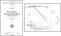 |
|
| B-33 | 1947 | Bibliography of the geology and mineral resources of Oregon: first supplement, July 1, 1936 to December 31, 1945, compiled by John Eliot Allen, with contributions by Elinor Kinsley, Hazel Quasdorf, and Ray C. Treasher, 1947, 108 p. | ||
| B-32 | 1946 | Fifth biennial report of the State Department of Geology and Mineral Industries of the State of Oregon, 1944-1946, by W. H. Strayer, S. H. Williston, and Niel R. Allen, 1946, 36 p. |  |
|
| B-31 | 1946 | Geology of the St. Helens quadrangle, Oregon, by W. D. Wilkinson, Wallace D. Lowry, and Ewart M. Baldwin, 1946, 39 p., 1 pl., scale: 1:62,500. |  |
|
| B-30 | 1946 | Mineralogical and physical composition of the sands of the Oregon coast from Coos Bay to the mouth of the Columbia River, by W. H. Twenhofel, 1946, 64 p. | ||
| B-29 | 1945 | Ferruginous bauxite deposits in northwestern Oregon, by F. W. Libbey, Wallace D. Lowry, and Ralph S. Mason, 1945, 97 p., 1 pl., scale: 1:4,800. |  |
|
| B-28 | 1944 | Fourth biennial report of the State Department of Geology and Mineral Industries of the State of Oregon, 1942-1944, by W. H. Strayer, S. H. Williston, and Niel R. Allen, 1944, 29 p. |  |
|
| B-27 | 1944 | Geology and coal resources of the Coos Bay quadrangle, Oregon, by John Eliot Allen and Ewart M. Baldwin, 1944, 160 p., 4 pl., scale: Coos Bay quadrangle, 1:125,000; Plate 1, 1:96,500; Plate 10, no scale given; Plate 20, 1:3,555.5. |  |
|
| B-26 | 1944 | Soil: the most valuable mineral resource. Its origin, destruction, and preservation, by W. H. Twenhofel, 1944, 47 p. |  |
|
| B-25 | 1943 | Third biennial report of the State Department of Geology and Mineral Industries of the State of Oregon, 1941-1942, by W. H. Strayer, Albert Burch, and E. B. MacNaughton, 1943, 36 p. | ||
| B-24 | 1943 | Origin of the black sands of the coast of southwest Oregon, by W. H. Twenhofel, 1943, 25 p. |  |
|
| B-23 | 1942 | An investigation of the reported occurrence of tin at Juniper Ridge, Oregon, by H. C. Harrison and John Eliot Allen, 1942, 54 p. |  |
|
| B-22 | n/a | n/a | never published | |
| B-21 | 1941 | Second biennial report of the State Department of Geology and Mineral Industries of the State of Oregon, 1939-1940, 1941, 57 p. | ||
| B-20 | 1940 | Analyses and other properties of Oregon coals as related to their utilization, by H.F. Yancey and M. R. Geer, 1940, 38 p. |  |
|
| B-19 | 1939 | Dredging of farmland in Oregon, by F. W. Libbey, 1939, 40 p. |  |
|
| B-18 | 1939 | First aid to fossils: what to do before the paleontologist comes, by John Eliot Allen, 1939, 28 p. |  |
|
| B-17 | 1942 | Manganese in Oregon, by F. W. Libbey, John Eliot Allen, Ray C. Treasher, and H. K. Lancaster, 1942, 78 p. |  |
|
| B-16 | 1940 | Field identification of minerals for Oregon prospectors and collectors, by Ray C. Treasher, 1940, 133 p. First edition, July 1940; second edition, May 1941; fourth printing, August 1949. 1940-1954. |  |
|
| B-15 | 1939 | Geology of the Salem Hills and the North Santiam River basin, Oregon, by Thomas Prence Thayer, 1939, 40 p., 1 pl., scale: 1:126,720. |  |
|
| B-14-E | n/a | n/a | Oregon metal mines handbook, central and southeastern Oregon. Never published. | |
| B-14-D | 1951 | Oregon metal mines handbook, northwestern Oregon, 1951, 166 p. |  |
|
| B-14-C, vol. 2, sec. 2 | 1942 | Oregon metal mines handbook, volume 2; section 2, Jackson County, 1942, 208 p. |  |
|
| B-14-C, vol. 2, sec. 1 | 1952 | Oregon metal mines handbook, volume 2; section 1, Josephine County, 2nd ed., 1952, 238 p. | |
|
| B-14-C, vol. 1 | 1940 | Oregon metal mines handbook, volume 1; Coos, Curry, and Douglas Counties, 1940, 133 p. | |
|
| B-14-B | 1941 | Oregon metal mines handbook, northeastern Oregon — west half (Grant, Morrow, and Umatilla counties), 1941, 157 p. |  |
|
| B-14-A | 1939 | Oregon metal mines handbook, northeastern Oregon — east half, 1939, 125 p., scale: 1:253,440 |  |
|
| B-13 | 1939 | First biennial report of the State Department of Geology and Mineral Industries of the State of Oregon, 1937-1938, by W. H. Strayer, Albert Burch, and E.B. MacNaughton, 1939, 41 p. |  |
|
| B-12 | 1941 | Geology and physiography of the northern Wallowa Mountains by Warren Du Pre Smith, John Eliot Allen, Lloyd W. Staples, and Wayne R. Lowell, 1941, 64 p., scale 1:95,040. 1 geol. map.-- Abs. in Geol. Soc. Am. Bull., v. 52, no. 12, pt. 2, p. 1956, Dec. 1, 1941; includes contributions on petrography by Lloyd William Staples, and glaciation by Wayne Russell Lowell. |
 |
|
| B-11 | 1938 | The geology and mineral resources of Lane County, Oregon, by Warren Du Pre Smith and Lloyd L. Ruff, 1938, 65 p. |  |
|
| B-10 | 1938 | Placer mining on the Rogue River, Oregon, in its relation to the fish and fishing in that stream, by Henry Baldwin Ward, 1938, 31 p. |  |
|
| B-9 | 1938 | Chromite deposits in Oregon, by John Eliot Allen, H.F. Byram, and F.W. Lee, 1938, 71 p. | ||
| B-8 |
1938 | An investigation of the feasibility of a steel plant in the Lower Columbia River area near Portland, Oregon, by Raymond M. Miller, 1938, 55 p. |  |
|
| B-7 | 1938 | The gem minerals of Oregon, by Dr. H. C. Dake, 1938, 17 p. |  |
|
| B-6 | 1938 | PDF 89 MB |
Preliminary report of some of the refractory clays of western Oregon, by Hewitt Wilson and Ray C. Treasher, 1938, 93 p. |  |
| B-5 | 1938 | Geological report on part of the Clarno Basin, Wheeler and Wasco Counties, Oregon, by Donald K. Mackay, 1938, 11 p. |  |
|
| B-4 | 1938 | PDF 90 MB |
Quicksilver in Oregon, by C. N. Schuette, 1938, 172 p. | |
| B-3 | 1938 | The geology of part of the Wallowa Mountains, by C. P. Ross, 1938, 74 p., scale 1:100,000. |  |
|
| B-2 | 1937 | Progress report on Coos Bay Coal Field, by F. W. Libbey, 1937, 16 p. |  |
|
| B-1 | 1937 | Mining laws of the State of Oregon, 1937; 2nd rev., 1939; 3rd rev., 1951; 4th rev. 1954, 33 p. |  |