Special Papers
Comprehensive reports of lasting interest and scientific importance on a single topic or study extent.
Click the up/down arrow in the table heading to sort by that column.| No. | Year | Format | Details | Thumbnail |
|---|---|---|---|---|
| SP-53 | 2022 | preview/download | Special Paper 53, Protocol for Channelized Debris Flow Susceptibility Mapping, by William J. Burns, Jon J. Franczyk, and Nancy C. Calhoun. | 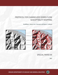 |
| SP-52 | 2019 | preview/download | Special Paper 52, The Scarp Identification and Contour Connection Method (SICCM): A Tool for Use in Semi-Automatic Landslide Mapping, by Michael Bunn, Ben A. Leshchinsky, Michael J. Olsen, Nancy C. Calhoun, Jon J. Franczyk, and William J. Burns. |  |
| SP-51 | 2018 | preview/download | Special Paper 51, Columbia River tsunami modeling: toward improved maritime planning response, by Jonathan C. Allan, Joseph Zhang, Fletcher E. O'Brien, and Laura L. Gabel, 2018, 77 p., 2 animations. Also see Maritime Tsunami Response Guidance (MTRG) MTRG-2018-OR-01 Port of Astoria and Lower Columbia River Estuary |
 |
| SP-50 | 2018 | preview/download | Flood risk assessment for the Columbia Corridor drainage districts in Multnomah County, Oregon, by Christina A. Appleby and John M. Bauer, 109 p., GIS data. |  |
| SP-49 | 2018 | preview/download | Beach and shoreline dynamics in the Cannon Beach littoral cell: Implications for dune management, by Jonathan C. Allan, Fletcher E. O’Brien, and Laura L. Gabel, 2018, 118 p. |  |
| SP-48 | 2016 | preview/download | Protocol for deep landslide susceptibility mapping, by William J. Burns and Katherine A. Mickelson, 2016, 66 p. |  |
| SP-47 | 2015 | preview/download | Coastal flood hazard study, Tillamook County, Oregon, by Jonathan C. Allan, Peter Ruggiero, Gabriel Garcia, Fletcher E. O'Brien, Laura L. Stimely, and Jed T. Roberts, 2015, 274 p. |  |
| SP-46 | 2015 | preview/download | Surficial and bedrock engineering geology, landslide inventory and susceptibility, and surface hydrography of the Bull Run Watershed, Clackamas and Multnomah Counties, Oregon, by William J. Burns, Katherine A. Mickelson, Cullen B. Jones, Mathew A. Tilman, and Dan E. Coe, 2015, 59 p., 1:24,000; 1:5,000. |  |
| SP-45 | 2012 | preview/download | Protocol for shallow-landslide susceptibility mapping, by William J. Burns, Ian P. Madin, and Katherine A. Mickelson, 2012, 32 p., 1:8,000. Includes DOGAMI SP-42, Landslide Inventory Protocol; and O-12-05, Plate 2 PDF. |  |
| SP-44 | 2012 | preview/download | Coastal Flood Insurance Study, Coos County, Oregon, by Jonathan C. Allan, Peter Ruggiero, and Jed T. Roberts, 2012, 127 p. |  |
| SP-43 | 2011 | preview/download | Simulating tsunami inundation at Bandon, Coos County, Oregon, using hypothetical Cascadia and Alaska earthquake scenarios, by Robert C. Witter, Yinglong Zhang, Kelin Wang, George R. Priest, Chris Goldfinger, Laura L. Stimely, John T. English, and Paul A. Ferro, 2011, 57 p., various. Includes report, plates, GIS and data files, and animations |  |
| SP-42 | 2009 | preview/download | Protocol for Inventory Mapping of Landslide Deposits from Light Detection and Ranging (Lidar) Imagery, by William J. Burns and Ian P. Madin, 2009, 30 p. Includes geodatabase template. |  |
| SP-41 | 2009 | .zip (739 MB) | Tsunami hazard assessment of the northern Oregon coast: A multi-deterministic approach tested at Cannon Beach, Clatsop County, Oregon, by George R. Priest, Chris Goldfinger, Kelin Wang, Robert C. Witter, Yinglong Zhang, and Antonio M. Baptista, 2009, 87 p. plus 7 p. appendix. Includes report, GIS set, time histories, and animations. |  |
| SP-40 | 2008 | .zip (83 MB) | Johnson Creek landslide research project, Lincoln County, Oregon: Final report to the Oregon Department of Transportation, by George R. Priest, Jonathan A. Allan, Alan R. Niem, Wendy A. Niem and Stephen E. Dickenson, 2008, 76 p. plus 14 appendices. |  |
| SP-39 | 2007 | Enhanced rapid visual screening (E-RVS) for prioritization of seismic retrofits in Oregon, by Yumei Wang and Kenneth A. Goettel, 2007, 27 p. |  |
|
| SP-38 | 2007 | Portland State University Ondine Residence Hall seismic rehabilitation demonstration project, by Yumei Wang and Christopher J. Heathman, 2007, 23 p. |  |
|
| SP-37 | 2005 | .zip | Dynamic revetments for coastal erosion stabilization: A feasibility analysis for application on the Oregon coast, by Jonathan C. Allan, Ron Geitgey, and Roger Hart, 2005, 67 p. PDF, GIS data set. |  |
| SP-36 | 2002 | Field guide to geologic processes in Cascadia: Field trips to accompany the 98th Annual Meeting of the Cordilleran Section of the Geological Society of America, May 13-15, 2002, Corvallis, Oregon, by George W. Moore, ed., 2002, 324 p. |  |
|
| SP-35 | 2001 | Tsunami warning systems and procedures: guidance for local officials, by Oregon Emergency Management and Oregon Department of Geology and Mineral Industries, 2001, 41 p. |  |
|
| SP-34 | 2000 | preview/download | Slope failures in Oregon: GIS inventory for three 1996/97 storm events, by R. Jon Hofmeister, 2000, 20 p. |  |
| SP-33 | 2000 | Penrose Conference 2000: Great Cascadia Earthquake Tricentennial, by John J. Clauge, Brian F. Atwater, Kelin Wang, Yumei Wang, and Ivan Wong, 2000, 156 p. |  |
|
| SP-32 | 1999 | Geologic hazards: Reducing Oregon's losses, by John D. Beaulieu and Dennis L. Olmstead, 1999, 27 p. |  |
|
| SP-31 | 1999 | Mitigating geologic hazards in Oregon: A technical reference manual, by John D. Beaulieu and Dennis L. Olmstead, 1999, 60 p. |  |
|
| SP-30 | 2000 | Earthquake-induced slope instability: Methodology of relative hazard mapping, western portion of the Salem Hills, Marion County, Oregon, by R. Jon Hofmeister, Yumei Wang, and David K. Keefer, 2000, 73 p. |  |
|
| SP-29 | 1999 | Earthquake damage in Oregon: Preliminary estimates of future earthquake losses, by Yumei Wang, and J. Lou Clark, 1999, 59 p. |  |
|
| SP-28 | 1997 | Earthquakes - Converging at Cascadia: Symposium proceedings, Association of Engineering Geologists 40th Annual meeting, Sept. 30-Oct. 4, 1997, Portland, Oregon, by Yumei Wang and Klaus K. E. Neuendorf (eds.), 1997, 90 p. AEG Special Paper 10. |  |
|
| SP-27 | 1995 | An economic analysis of construction aggregate markets and the results of a long-term forecasting model for Oregon, by Robert M. Whelan, 1995, 123 p. |  |
|
| SP-26 | 1992 | Onshore-offshore geologic cross section, northern Oregon Coast Range to Continental Slope, by Alan R. Niem; Norman S. MacLeod; Parke D. Snavely, Jr.; David Huggins; J. Daniel Fortier; H. Jack Meyer; Alan Seeling; and Wendy A. Niem, 1992, 10 p., 1:100,000. |  |
|
| SP-25 | 1992 | Pumice in Oregon, by Ronald P. Geitgey, 1992, 26 p., 1:1,000,000. |  |
|
| SP-24 | 1990 | Index to Proceedings of the Forum on the Geology of Industrial Minerals, First (1965) through Twenty-Fifth (1989), by Robert L. Bates (comp.), 1990, 43 p. |  |
|
| SP-23 | 1990 | Industrial rocks and minerals of the Pacific Northwest: Proceedings of the 25th Forum on the Geology of Industrial Minerals, April 30 to May 2, 1989, Portland, Oregon, by Ronald P. Geitgey and Beverly F. Vogt (eds.), 1990, 100 p. |  |
|
| SP-22 | 1990 | Silica in Oregon, by Ronald P. Geitgey and Gary L. Baxter, 1990, 18 p., 1:1,000,000. | ||
| SP-21 | 1987 | Field geology of the northwest quarter of the Broken Top 15 minute quadrangle, Deschutes County, Oregon, by Edward M. Taylor, 1987, 20 p., 1:24,000. |  |
|
| SP-20 | 1989 | Bentonite in Oregon: Occurrences, analyses, and economic potential, by Jerry J. Gray, Ronald P. Geitgey, and Gary L. Baxter, 1989, 28 p., 1:500,000. |  |
|
| SP-19 | 1989 | Limestone deposits in Oregon, by Howard C. Brooks, and Gary L. Baxter, 1989, 72 p., 1:1,000,000. |  |
|
| SP-18 | 1988 | Investigations of talc in Oregon, by Mark L. Ferns and Len Ramp, 1988, 52 p., Plate 1, 1:250,000; Plate 2, 1:12,000; Plate 3, 1:250,000; Plate 4, 1:12,000. |  |
|
| SP-17 | 1984 | Bibliography of Oregon paleontology, 1972-1983, by Elizabeth L. Orr and William N. Orr, 1984, 82 p. |  |
|
| SP-16 | 1983 | Index to the Ore Bin (1939-1978) and Oregon Geology (1979-1982), by Kathleen A. Mahoney and Margaret L. Steere, 1983, 46 p. |  |
|
| SP-15 | 1983 | Geology and geothermal resources of the central Oregon Cascade Range, by George R. Priest and Beverly F. Vogt (eds), 1983, 123 p., Plate 2, 1:24,000 Plate 3, 1:62,500. |  |
|
| SP-14 | 1982 | Geology and geothermal resources of the Mount Hood area, Oregon, by George R. Priest and Beverly F. Vogt (eds.), 1982, 100 p. |  |
|
| SP-13 | 1981 | Faults and lineaments of the Southern Cascades, Oregon, by C. F. Kienle, C. A. Nelson, and R. D. Lawrence, 1981, 23 p., 1:250,000. |  |
|
| SP-12 | 1980 | Geological linears of the northern part of the Cascade Range, Oregon, by Ramesh Venkatakrishnan, John G. Bond, and John D. Kauffman, 1980, 25 p., 1:250,000. |  |
|
| SP-11 | 1982 | Theses and dissertations on the geology of Oregon, by Klaus K. E. Neuendorf, Kathleen A. Mahoney, and Paul E. Staub, 1982, 16 p., 1:1,000,000. |  |
|
| SP-10 | 1980 | Tectonic rotation of the Oregon Western Cascades, by James Magill and Allan Cox, 1980, 67 p. |  |
|
| SP-9 | 1980 | Geology of the Breitenbush Hot Springs quadrangle, Oregon, by Craig M. White, 1980, 26 p., 1:62,500. |  |
|
| SP-8 |
1980 | Geology and geochemistry of Mt. Hood Volcano, by Craig M. White, 1980, 26 p. |  |
|
| SP-7 | 1979 | Pluvial Fort Rock Lake, Lake County, Oregon, by Ira S. Allison, 1979, 72 p. |  |
|
| SP-6 | 1980 | PDF |
Geology of the La Grande Area, Oregon, by Warren Barrash, John G. Bond, John D. Kauffman, and Ramesh Venkatakrishnan, 1980, 47 p., 1:24,000. |  |
| SP-5 | 1979 | Analysis and forecasts of the demand for rock materials in Oregon, by Julia M. Friedman, Ernest G. Niemi, and W. Ed Whitelaw, 1979, 84 p. |  |
|
| SP-4 | 1978 | PDF |
Heat flow of Oregon, by David D. Blackwell, Donald A. Hull, Richard G. Bowen, and John L. Steele, 1978, 42 p., 1:1,000,000. | 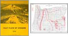 |
| SP-3 | 1978 | Rock material resources of Clackamas, Columbia, Multnomah, and Washington Counties, Oregon, by Jerry J. Gray, Garwood R. Allen, and Gregory S. Mack, 1978, 54 p., 1:62,500. |  |
|
| SP-2 | 1978 | Field geology of S.W. Broken Top quadrangle, Oregon, by Edward M. Taylor, 1978, 50 p. |  |
|
| SP-1 | 1978 | Mission, goals, and programs, 1979-1985: A six-year plan for geologic investigation, research, and regulation, 1978, 36 p. |  |
(last updated 04/15/2022)