Base Flood Elevation Determinations (BF)
Large-scale base flood elevation determinations for special flood hazard areas.
Note: DOGAMI no longer produces BFE reports.
Click the up/down arrow in the table heading to sort by that column.
All report PDFs include the map. Data bundles include the report, map, and GIS data (Personal GDB and grids).
| No. | Report | Data Bundle | Details | Thumbnail |
|---|---|---|---|---|
| BF-16-02 | .zip file (472 MB) | Base Flood Elevation Determination for Reaches of Lake Creek, Deadwood Creek, and Nelson Creek Near Deadwood, Lane County, Oregon, by Jed T. Roberts and Matt C. Williams, 2016, 11 p. | 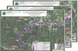 |
|
| BF-16-01 | .zip file (267 MB) | Base Flood Elevation Determination for Lower Reach of Gate Creek Near Vida, Lane County, Oregon, by Jed T. Roberts and Matt C. Williams, 2016, 11 p. | 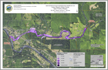 |
|
| BF-15-02 | .zip file (546 MB) | Base Flood Elevation Determination for Reaches of Frazier Creek and Mountain View Creek, Benton County, Oregon, by Jed T. Roberts and Matt C. Williams, 2015, 9 p. | 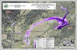 |
|
| BF-15-01 | .zip file (979 MB) | Base Flood Elevation Determination for Reach of North Santiam River, Marion and Linn Counties, Oregon, by Jed T. Roberts and Matt C. Williams, 2015, 14 p. | 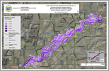 |
|
| BF-13-01 | .zip file (370 MB) | Base Flood Elevation Determination for Reaches of Lake Labish Ditch and Portions of Little Pudding River, Marion County, Oregon, by Jed T. Roberts and Daniel E. Coe, 2013, 9 p. | 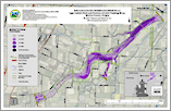 |
(last updated 06/10/2021)