[Go back] | Publications Center | DOGAMI Home
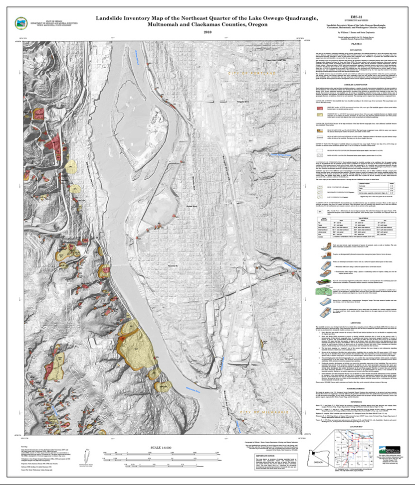
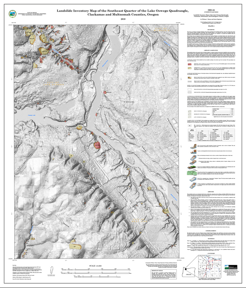
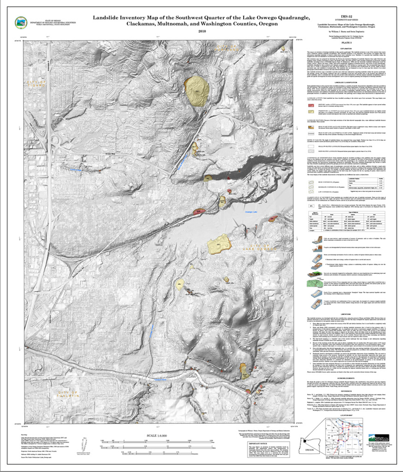
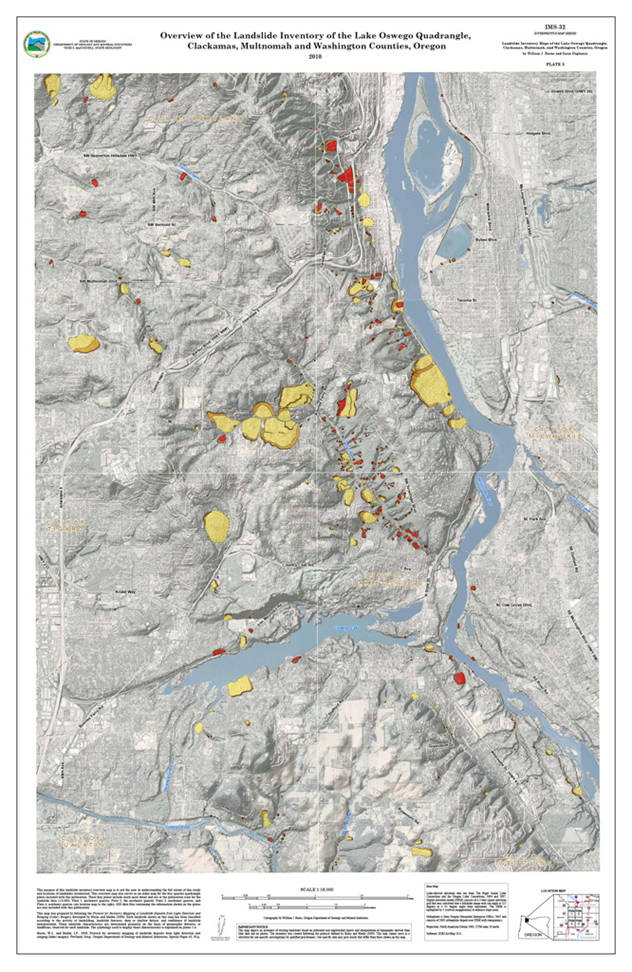
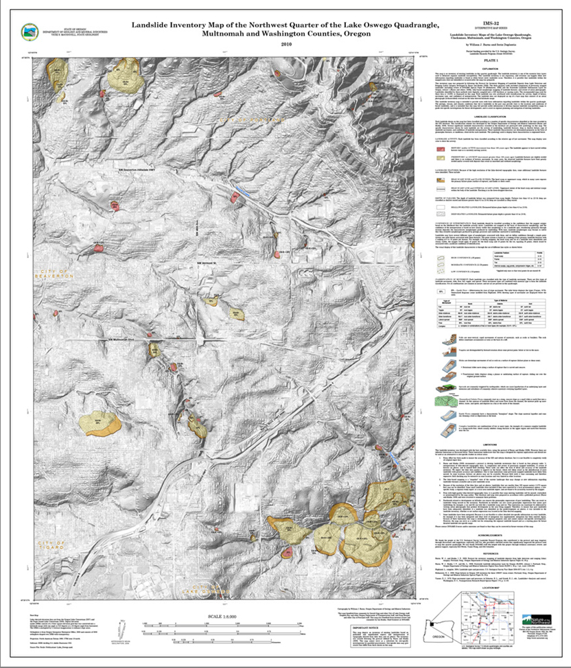
IMS-32, Landslide Inventory Maps of the Lake Oswego quadrangle, Clackamas, Multnomah, and Washington Counties, Oregon, by William J. Burns and Serin Duplantis.
(NW, NE, SE, and SW quarter quadrangle plates and overview plate of the Lake Oswego 7.5' quadrangle; 1:8,000 scale; 1:16,000 scale overview plate)
Download publication .zip file (248 MB)
IMS-32 contains the four quarter quadrangles that comprise the Lake Oswego 7.5' quadrangle, an overview plate that shows all four quarter quadrangles together, a geodatabase, metadata for the GIS files, and a readme.txt file, and:
- Special Paper 42, Protocol for inventory mapping of landslide deposits from light detection and ranging (lidar) imagery, by William J. Burns and Ian P. Madin -- included to provide background on how the landslide inventory data were prepared.
Individual plates (Plates 1-4: 36 x 42 inches; Plate 5: 30 x 42 inches).