DOGAMI Interpretive Map Series
[Go back] | Publications Center | DOGAMI Home
Publication Preview
 IMS-7, Relative earthquake hazard maps for selected urban areas in western Oregon: Dallas, Hood River, McMinnville-Dayton-Lafayette, Monmouth-Independence, Newburg-Dundee, Sandy, Sheridan-Willamina, St. Helens-Columbia City-Scappoose, by Ian P. Madin and Zhenming Wang, 1999, 24 p., 1:24,000. Download 66 MB .zip file. Zip file contains explanatory text, metadata, map sheets, and GIS files.
readme.txt (accompanies CD-ROM version of publication)
metadata text ( html | text )
explanatory text ( pdf | text )
Maps (jpg format):
Sheet 1 -- (all links below are to jpg files)
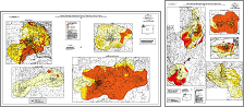
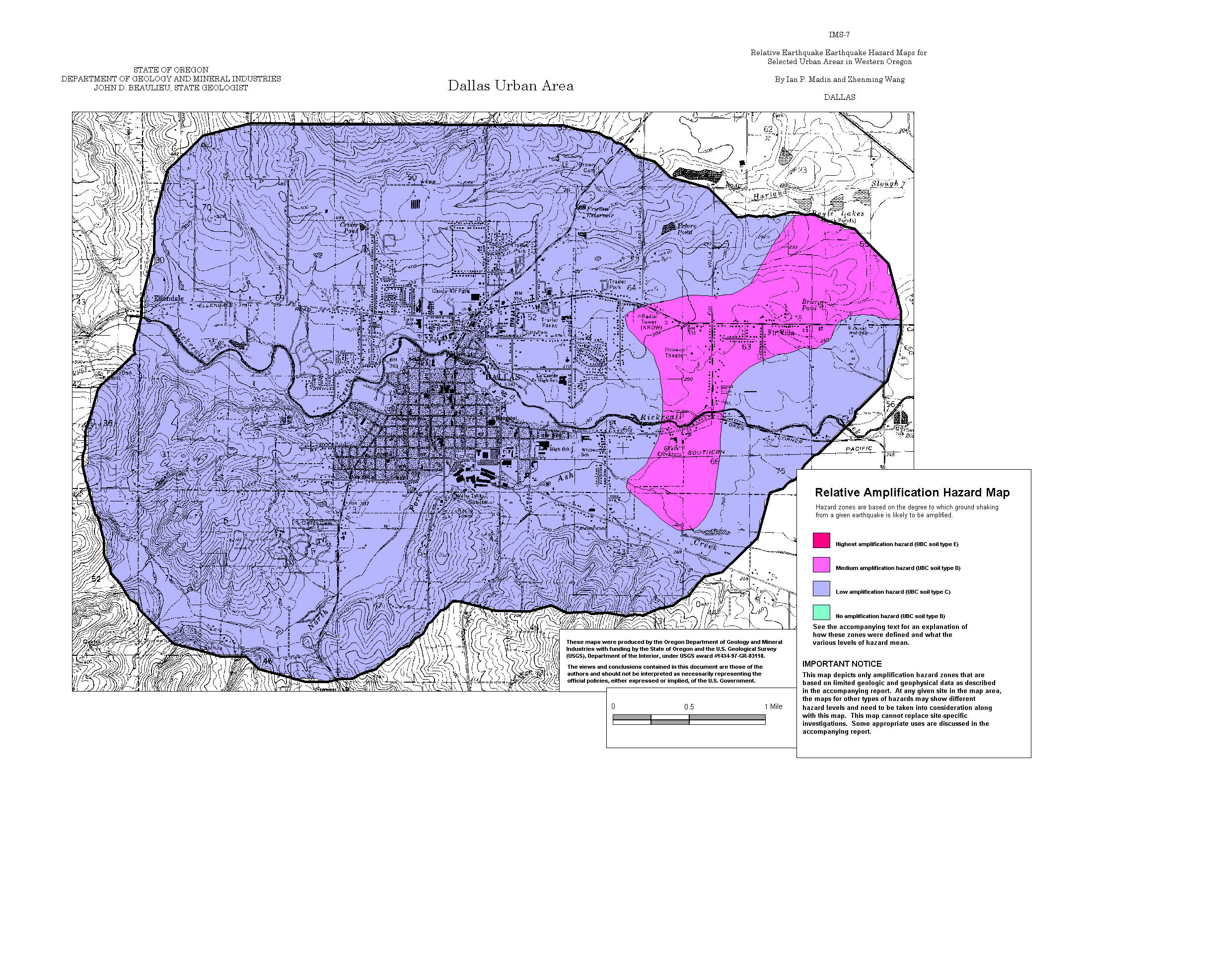
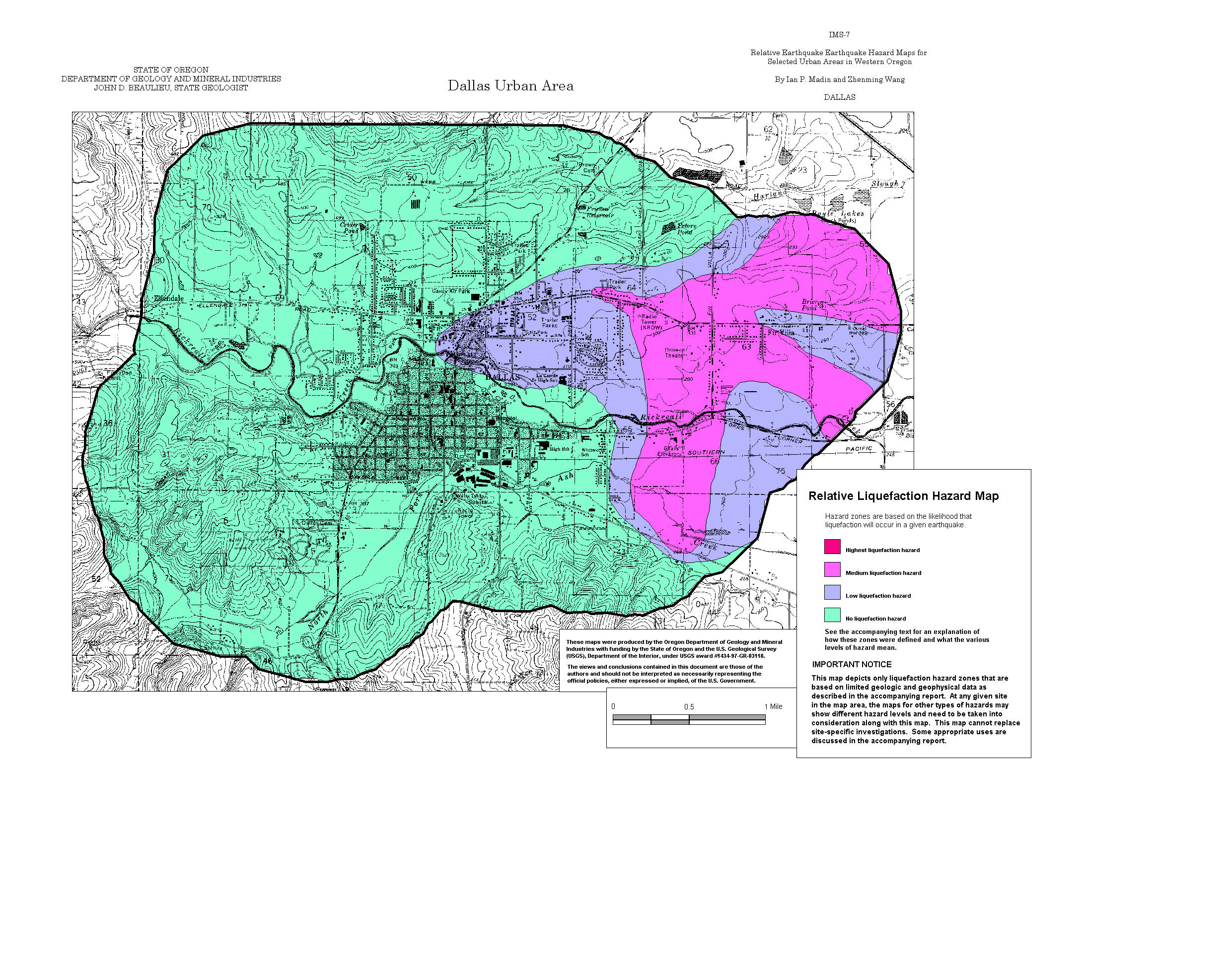
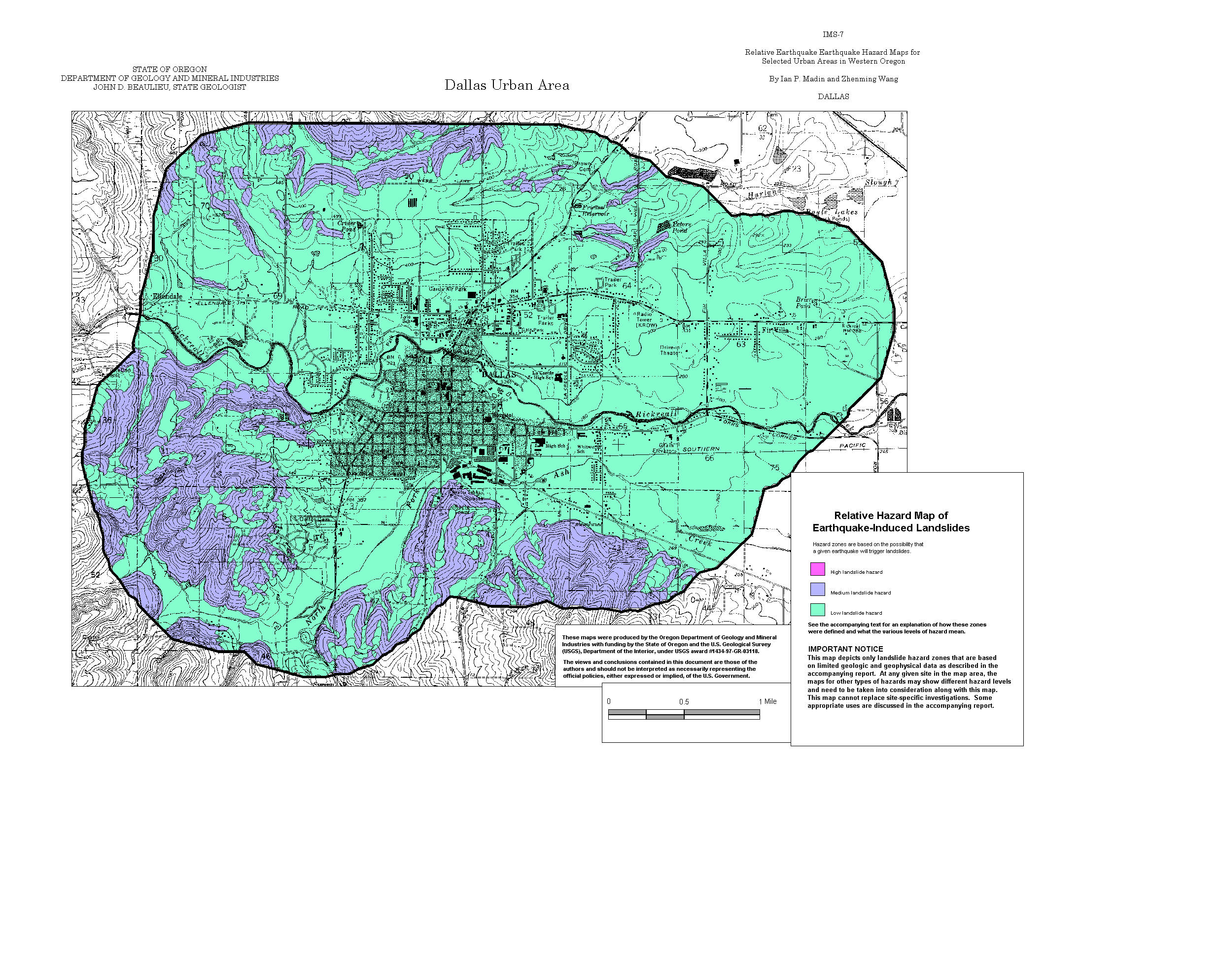
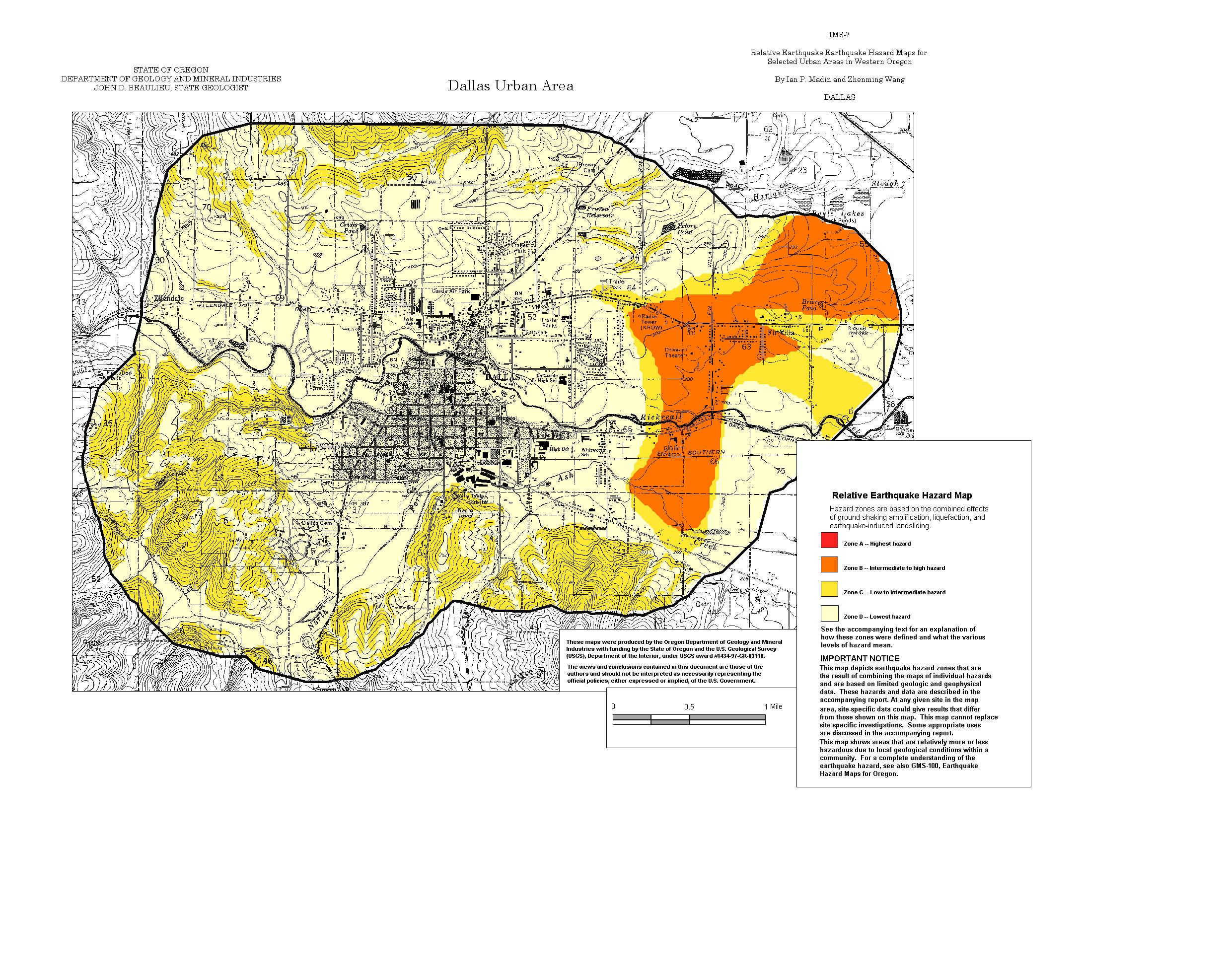
Dallas: Amplification, Liquefaction, Landslide, Relative Hazard
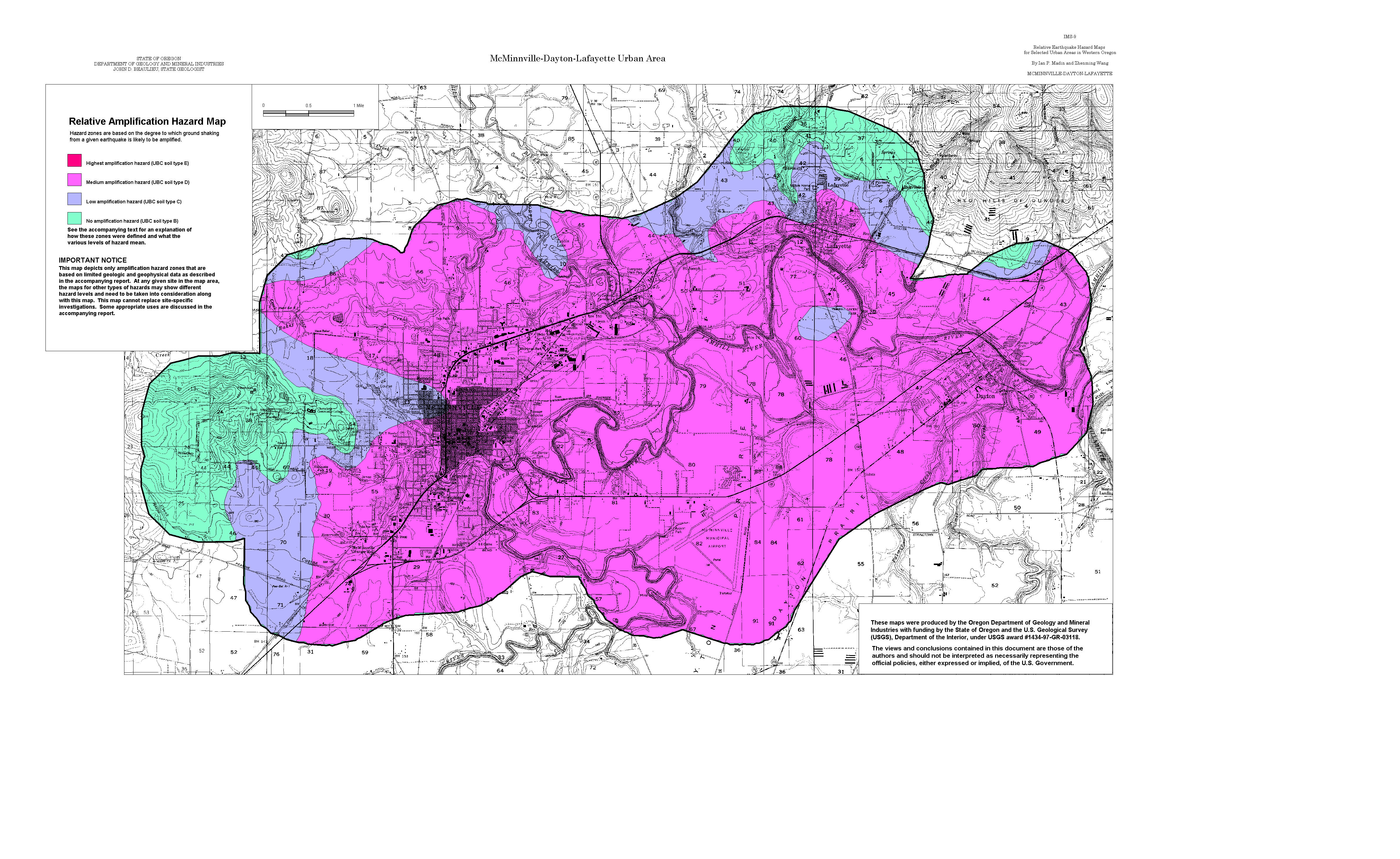
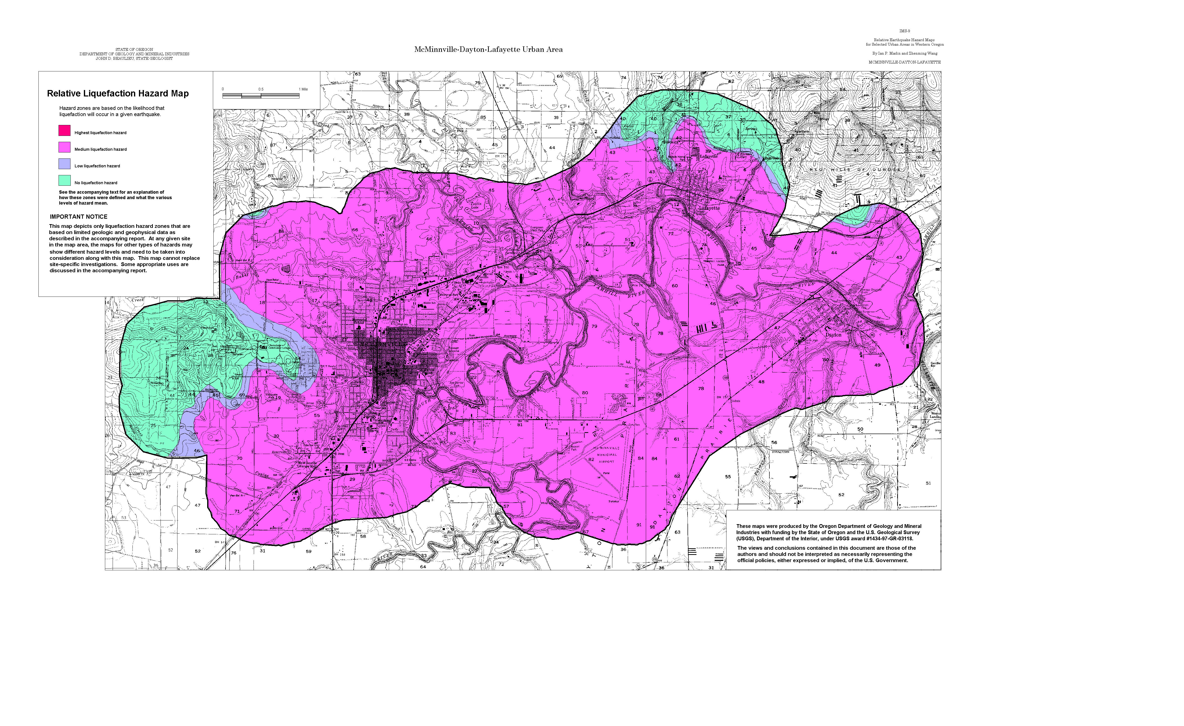
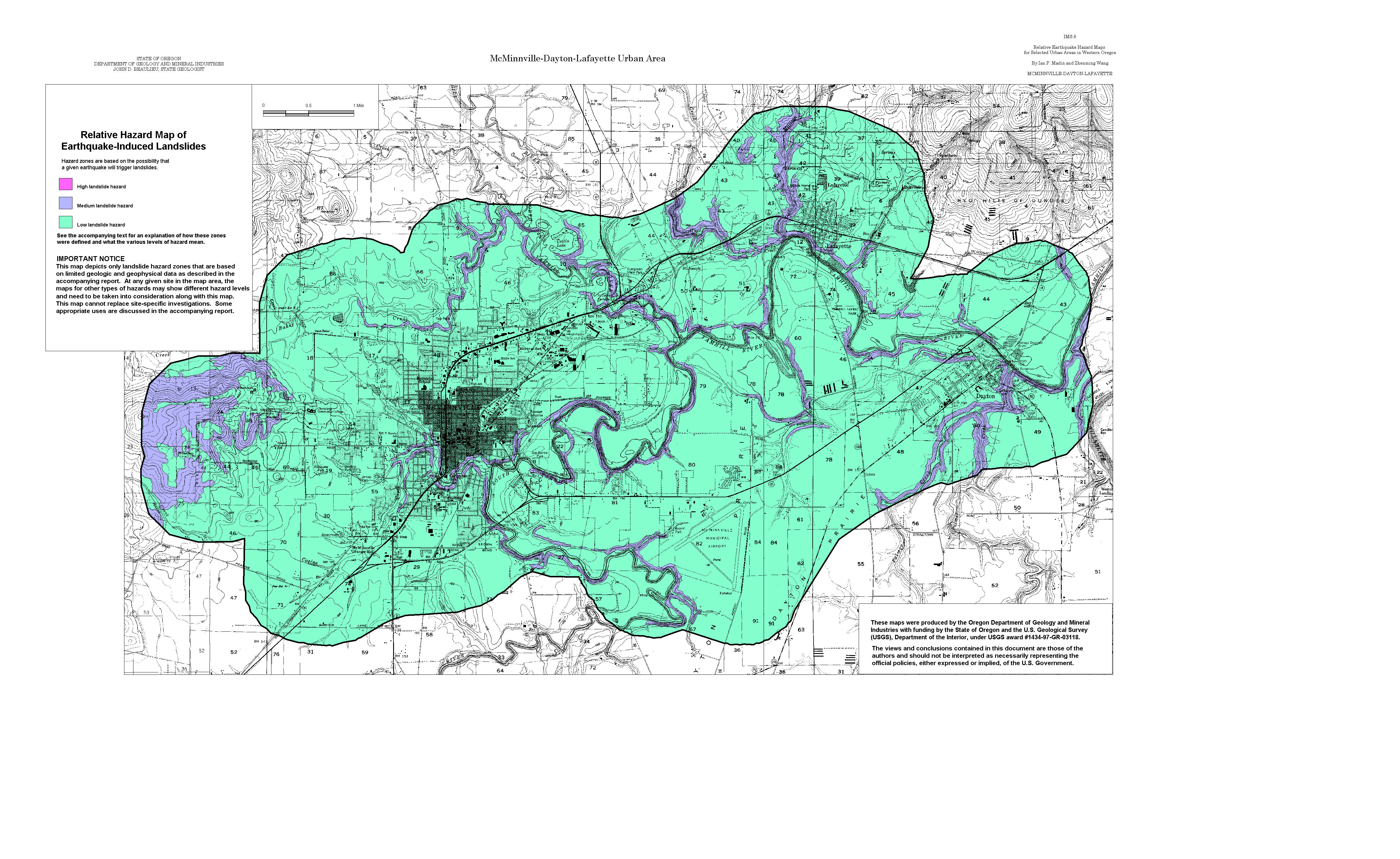
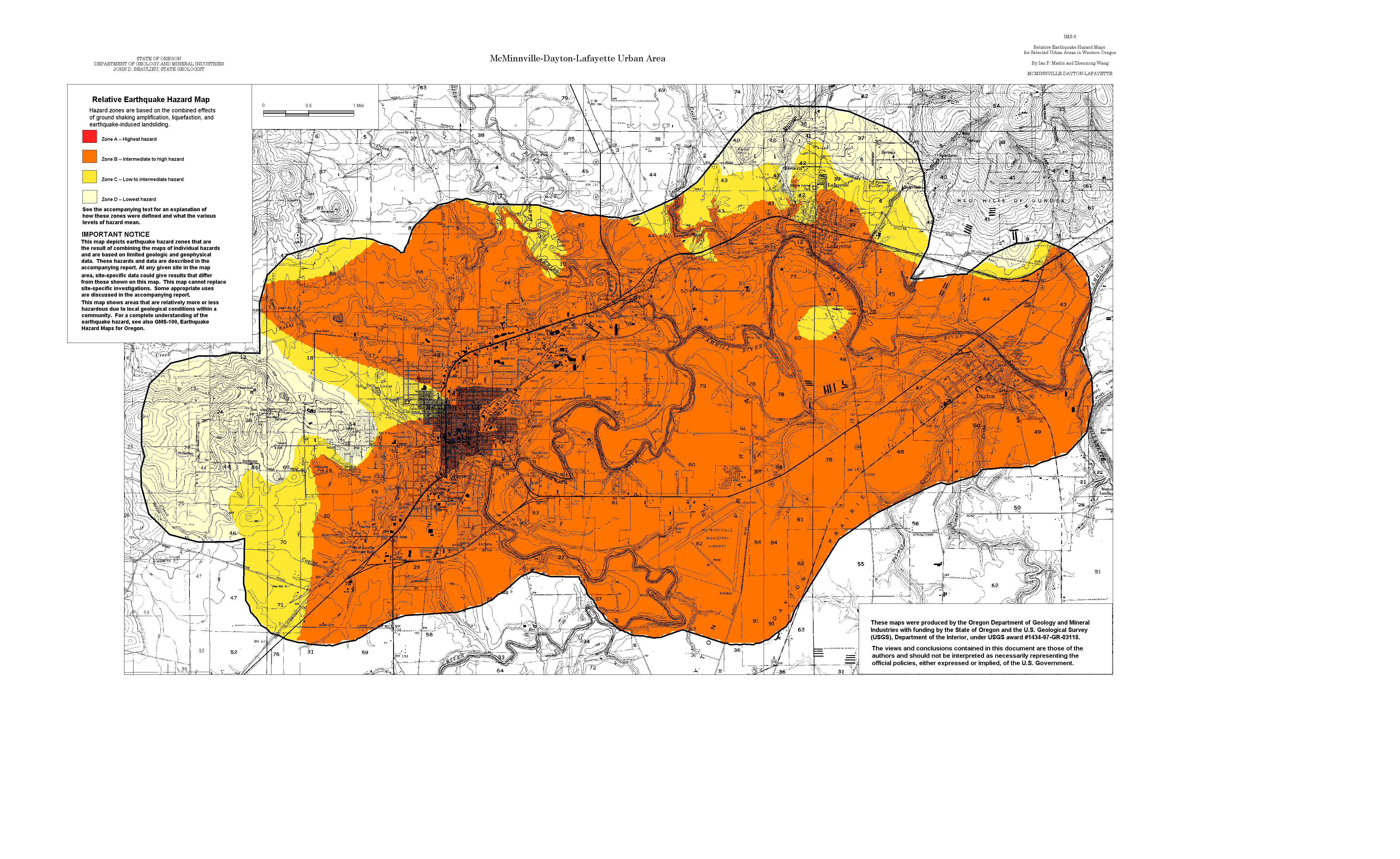
McMinnville-Dayton-Lafayette: Amplification, Liquefaction, Landslide, Relative Hazard
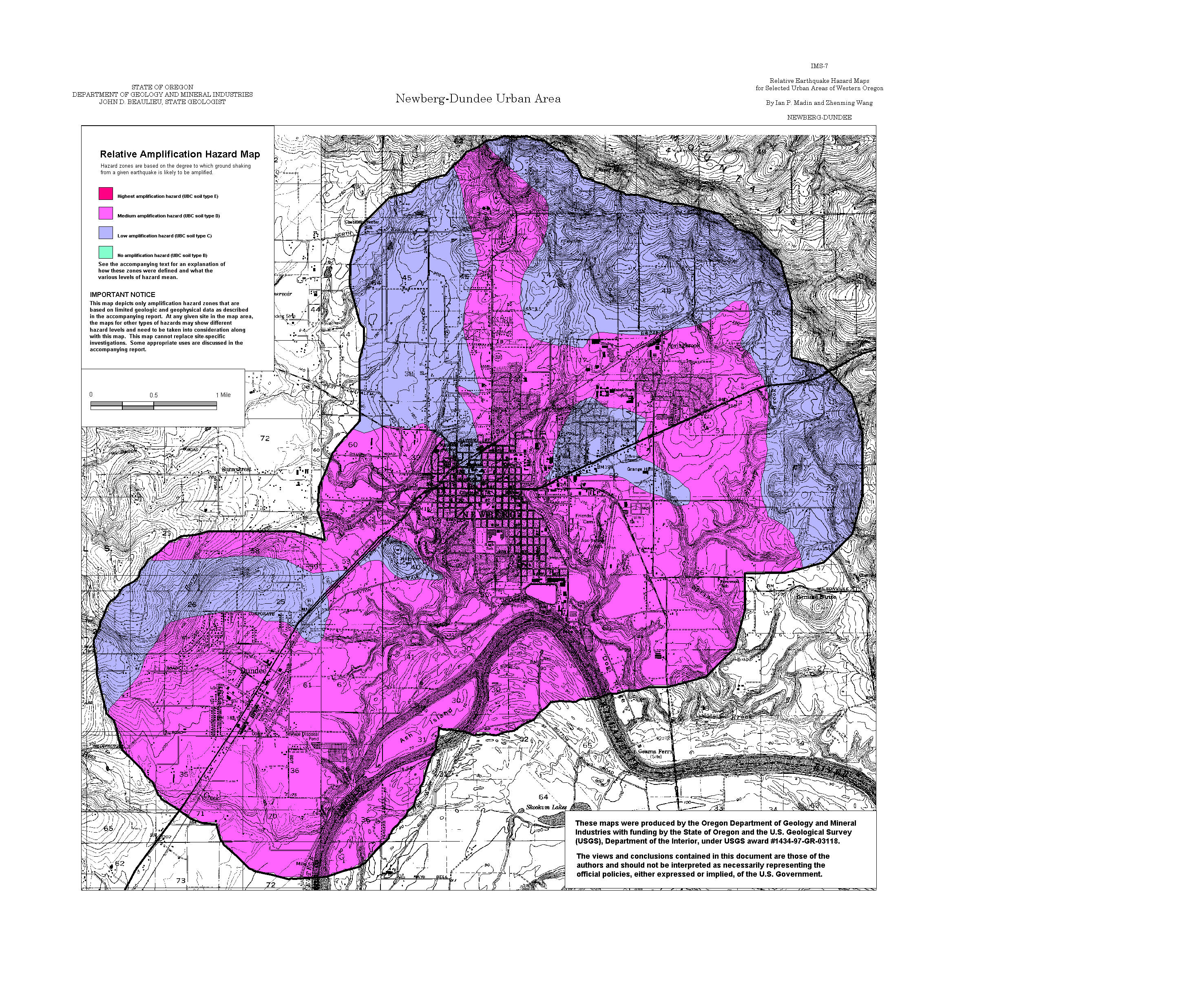
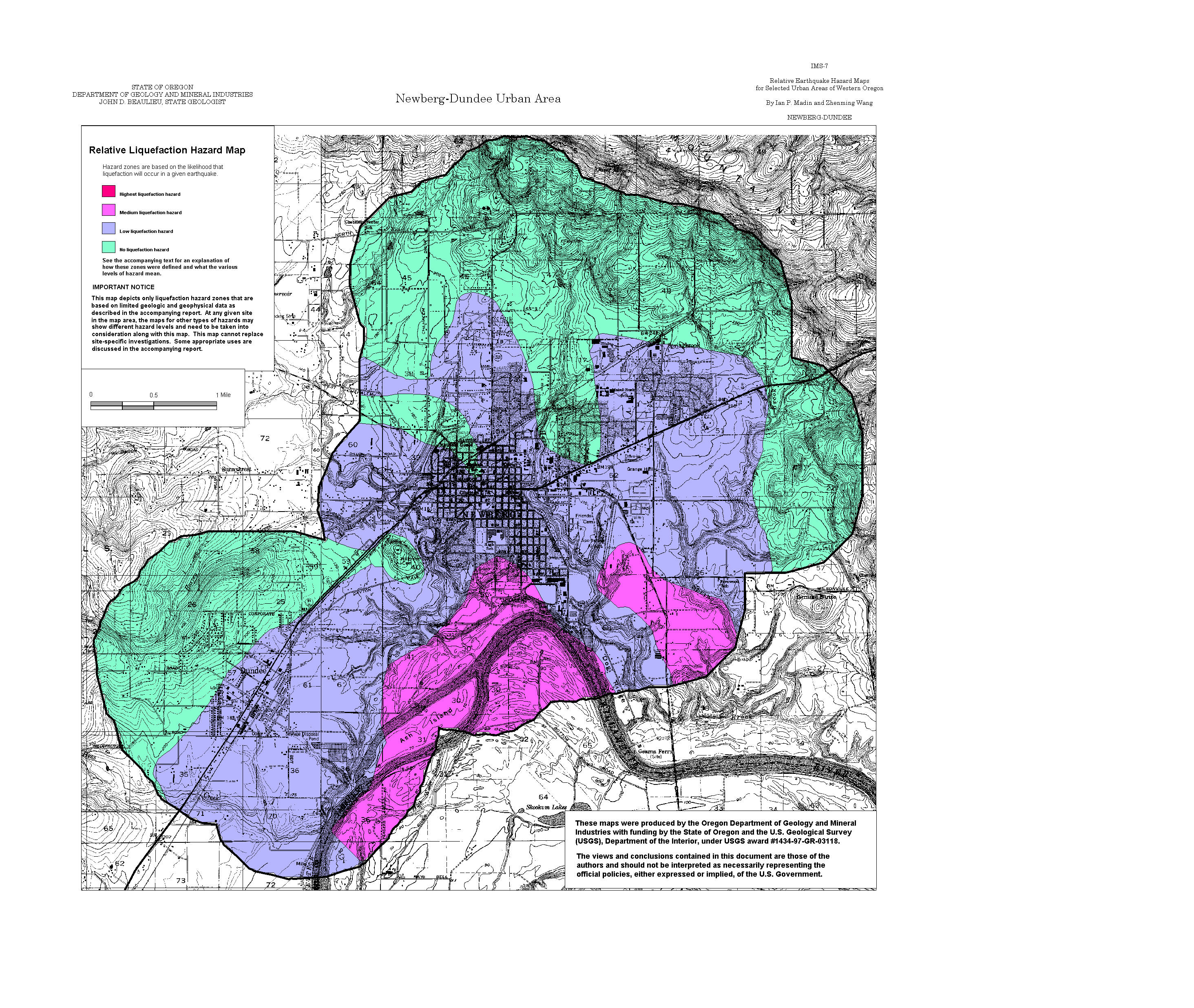
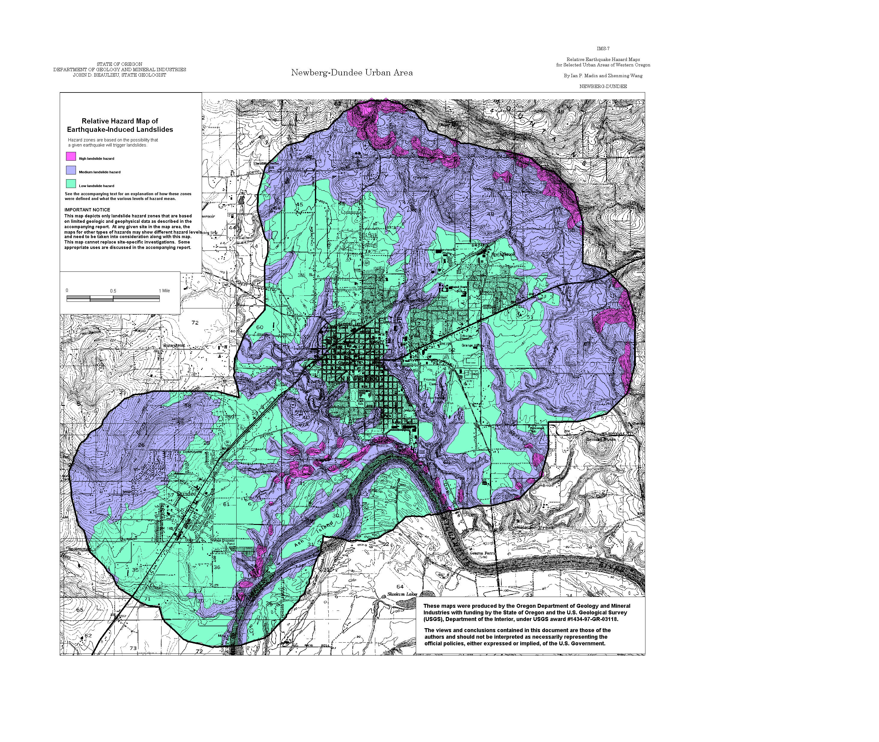
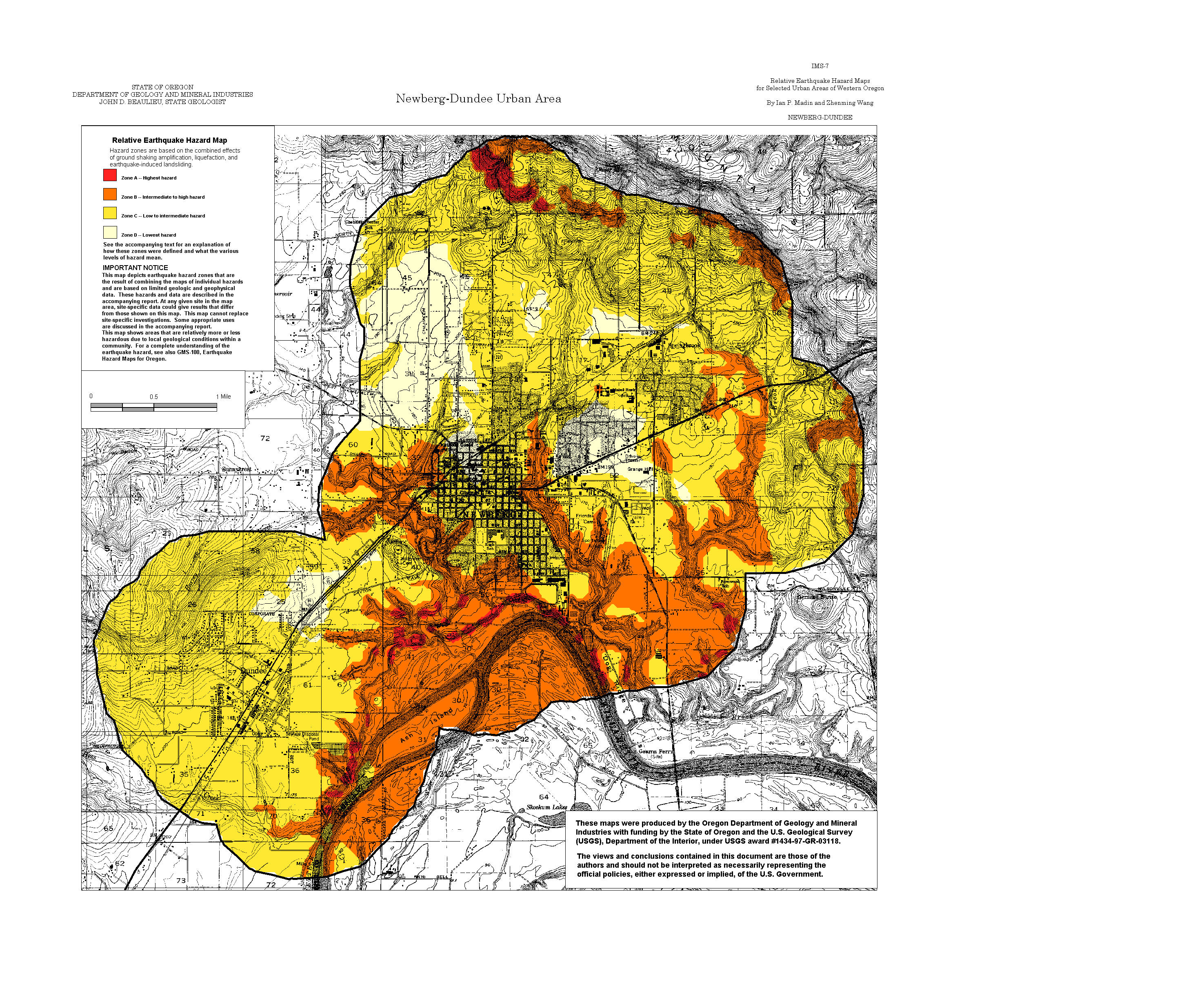
Newberg-Dundee: Amplification, Liquefaction, Landslide, Relative Hazard
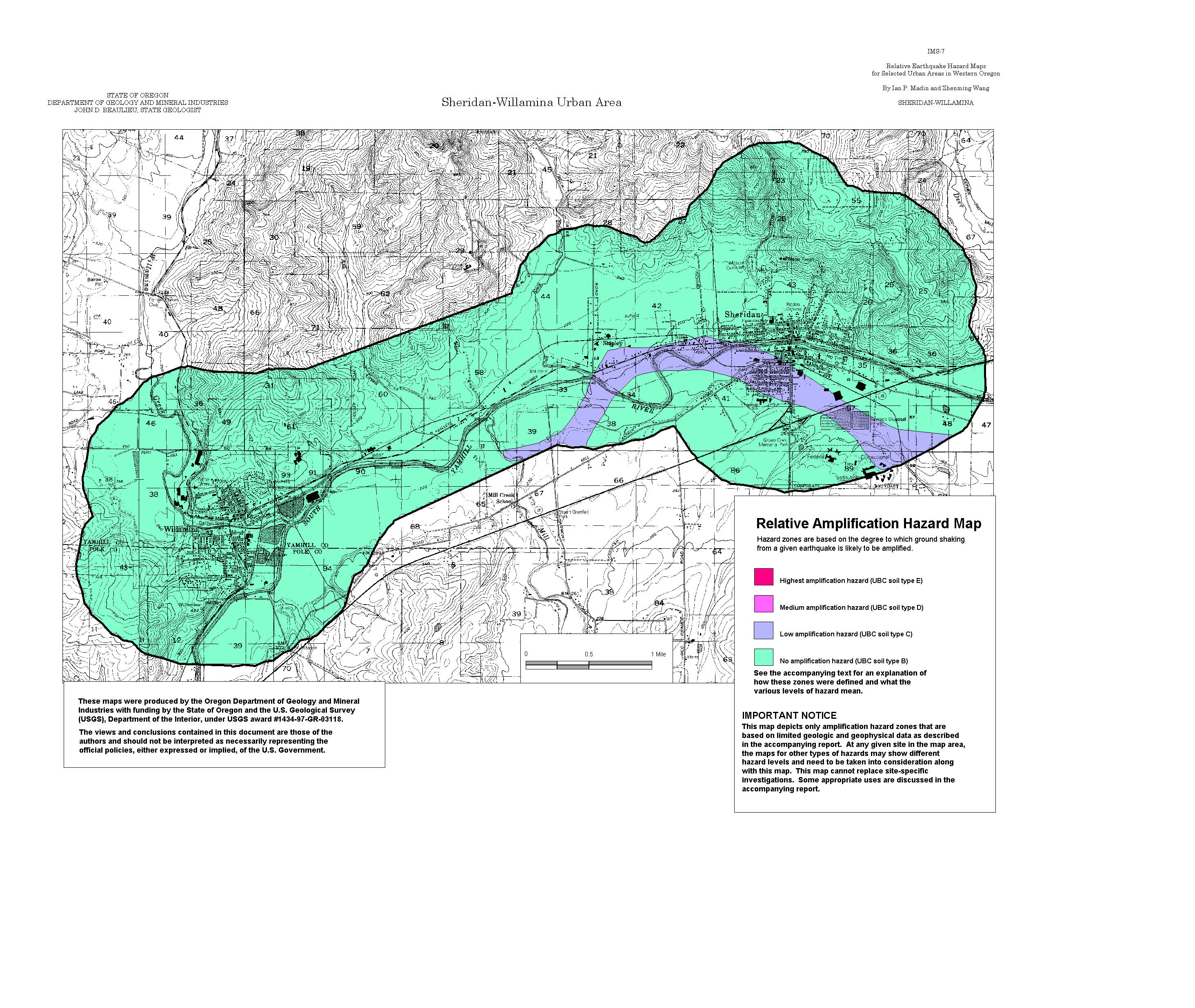
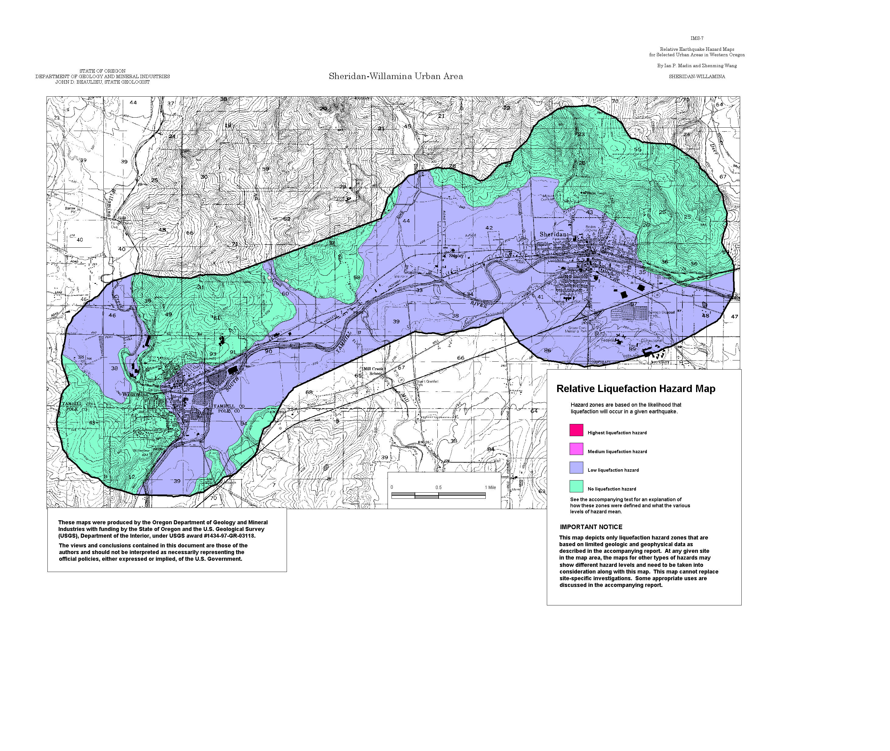
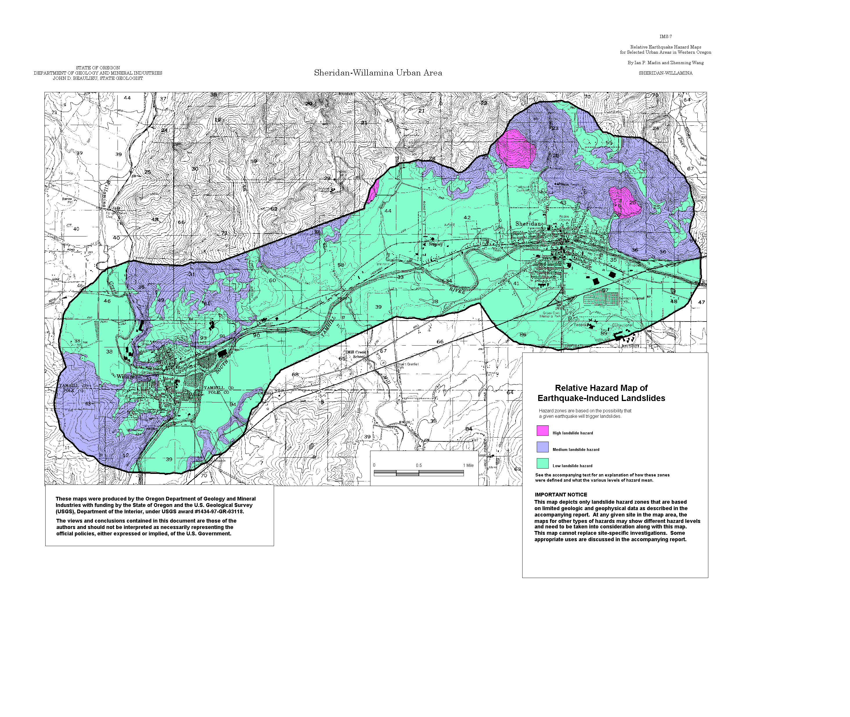
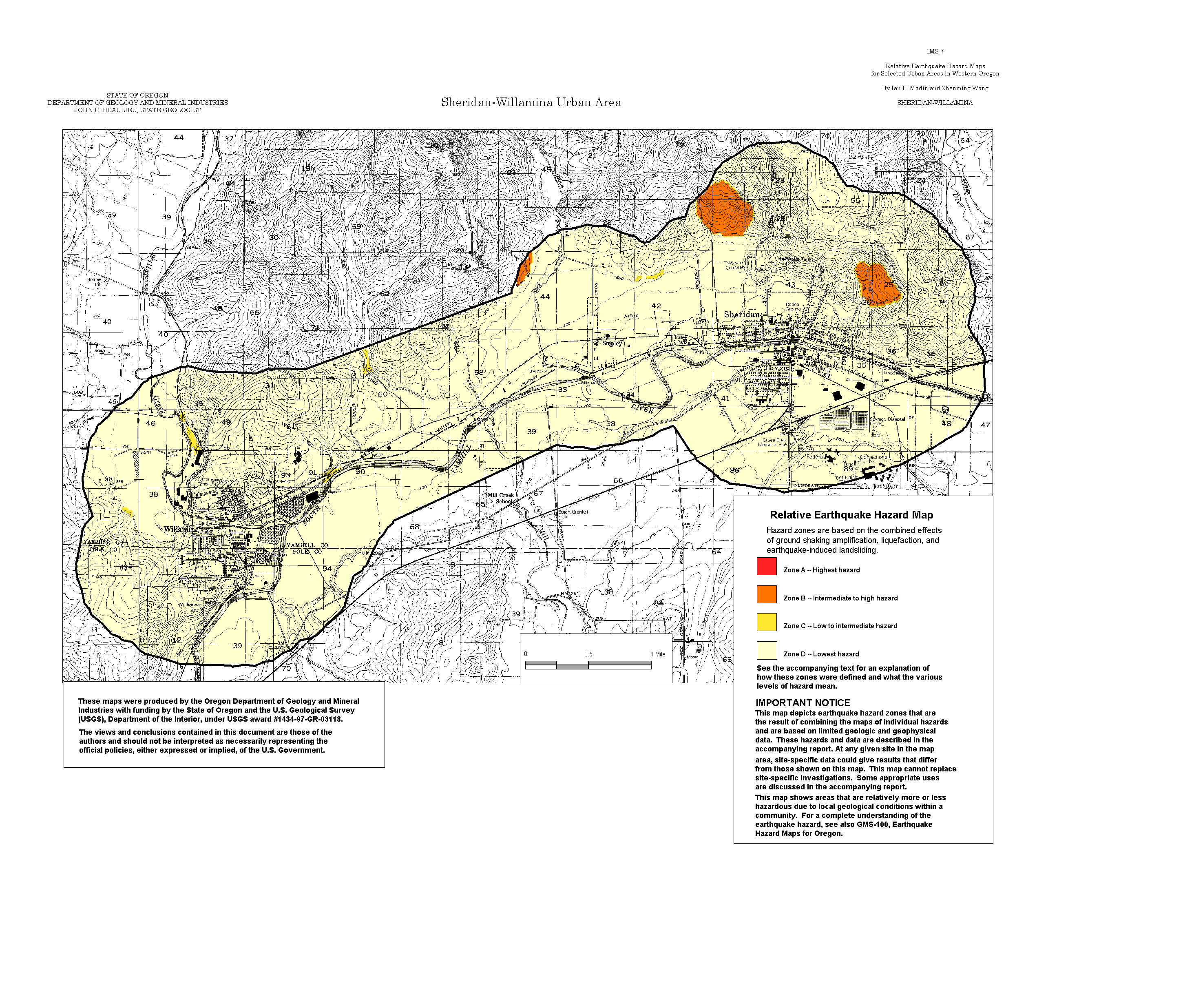
Sheridan-Willamina: Amplification, Liquefaction, Landslide, Relative Hazard
Sheet 2 -- (all links below are to jpg files)
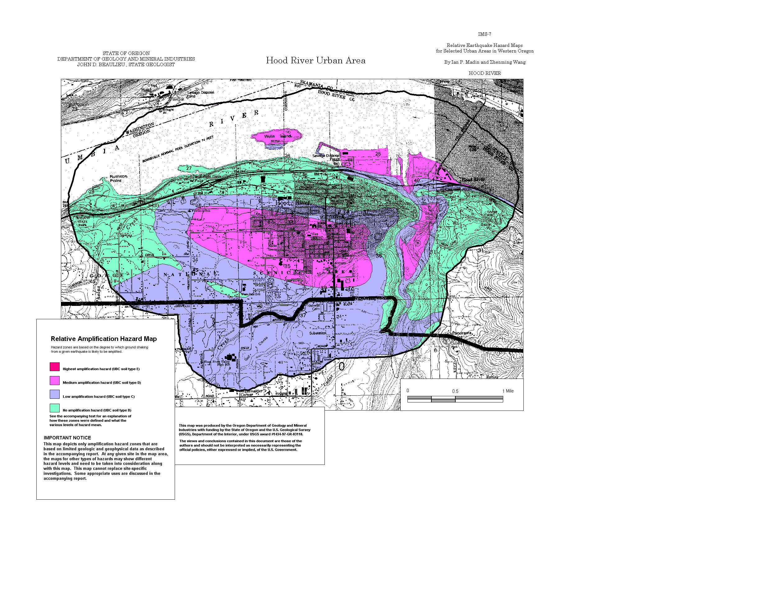
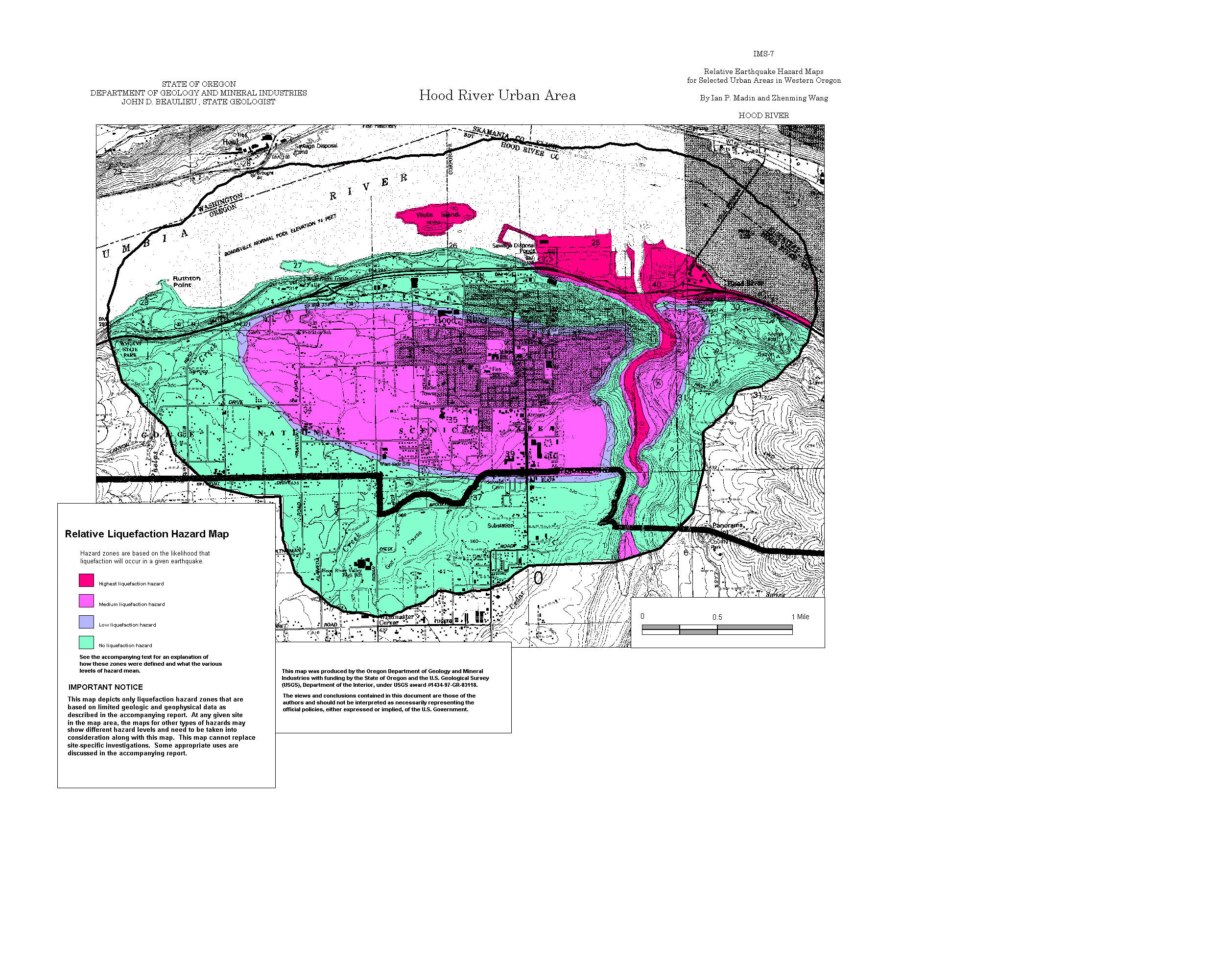
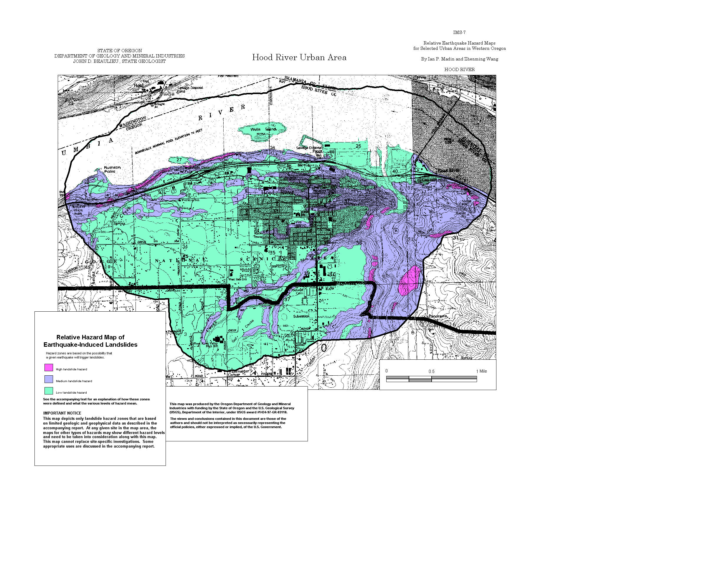
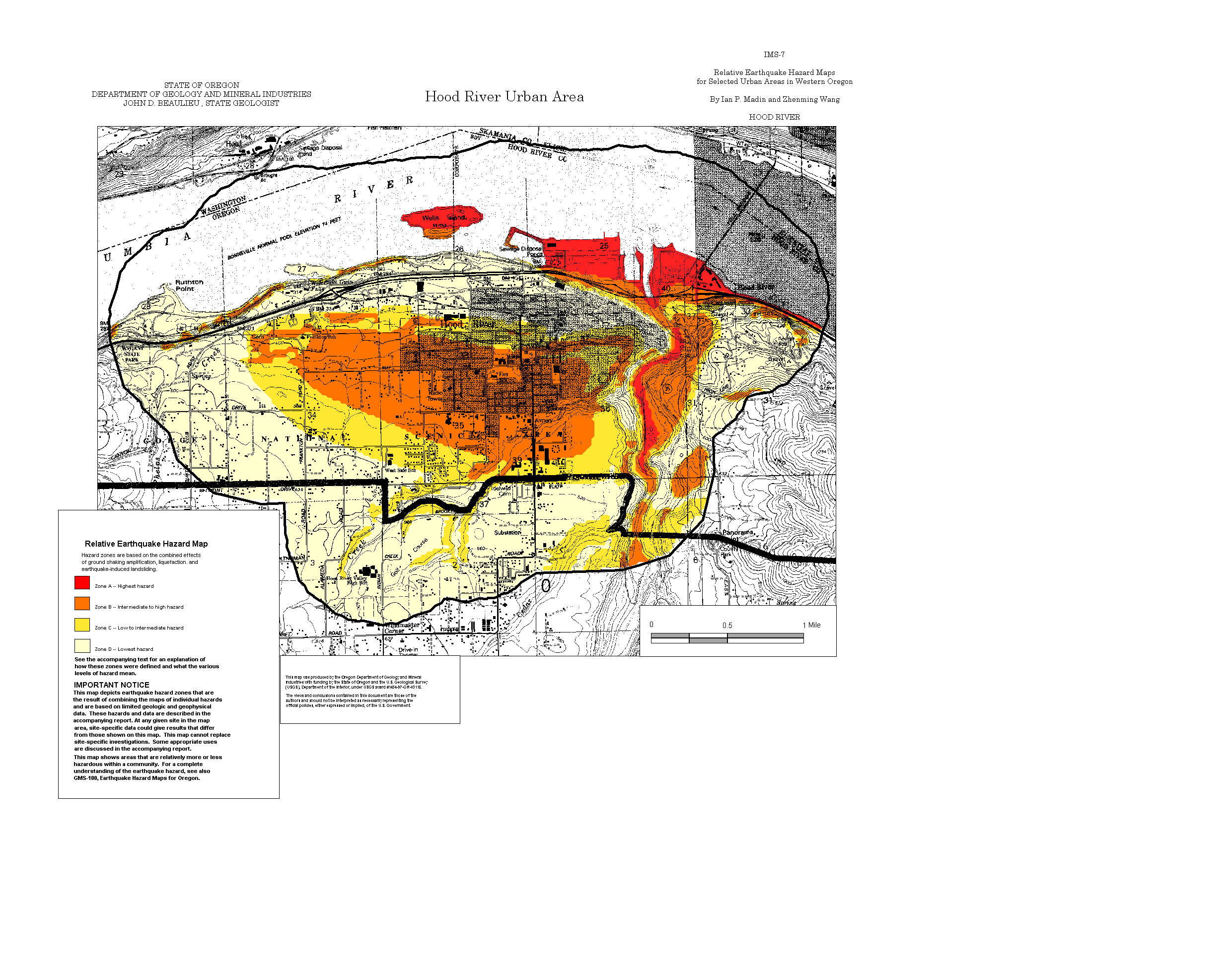
Hood River: Amplification, Liquefaction, Landslide, Relative Hazard
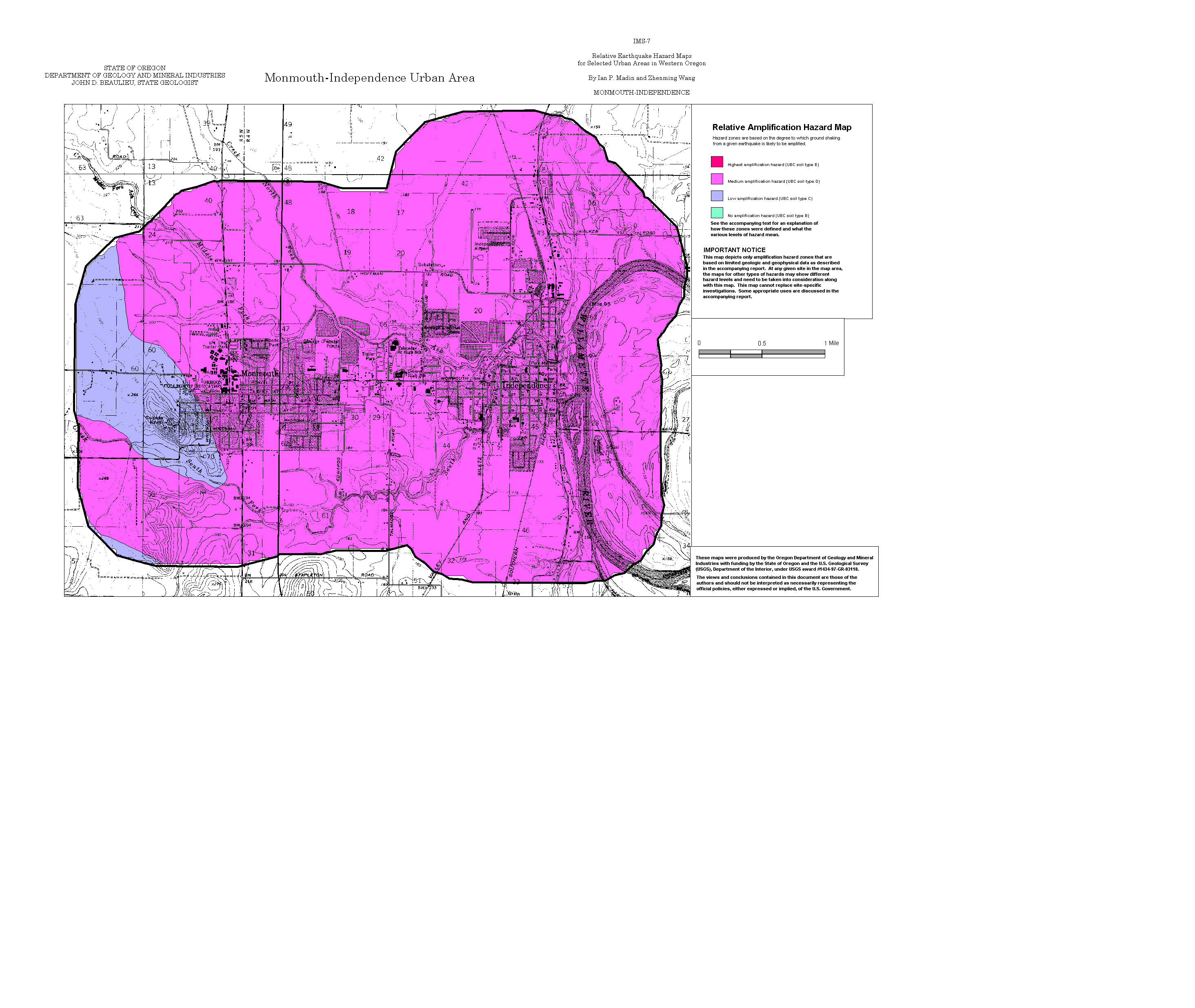
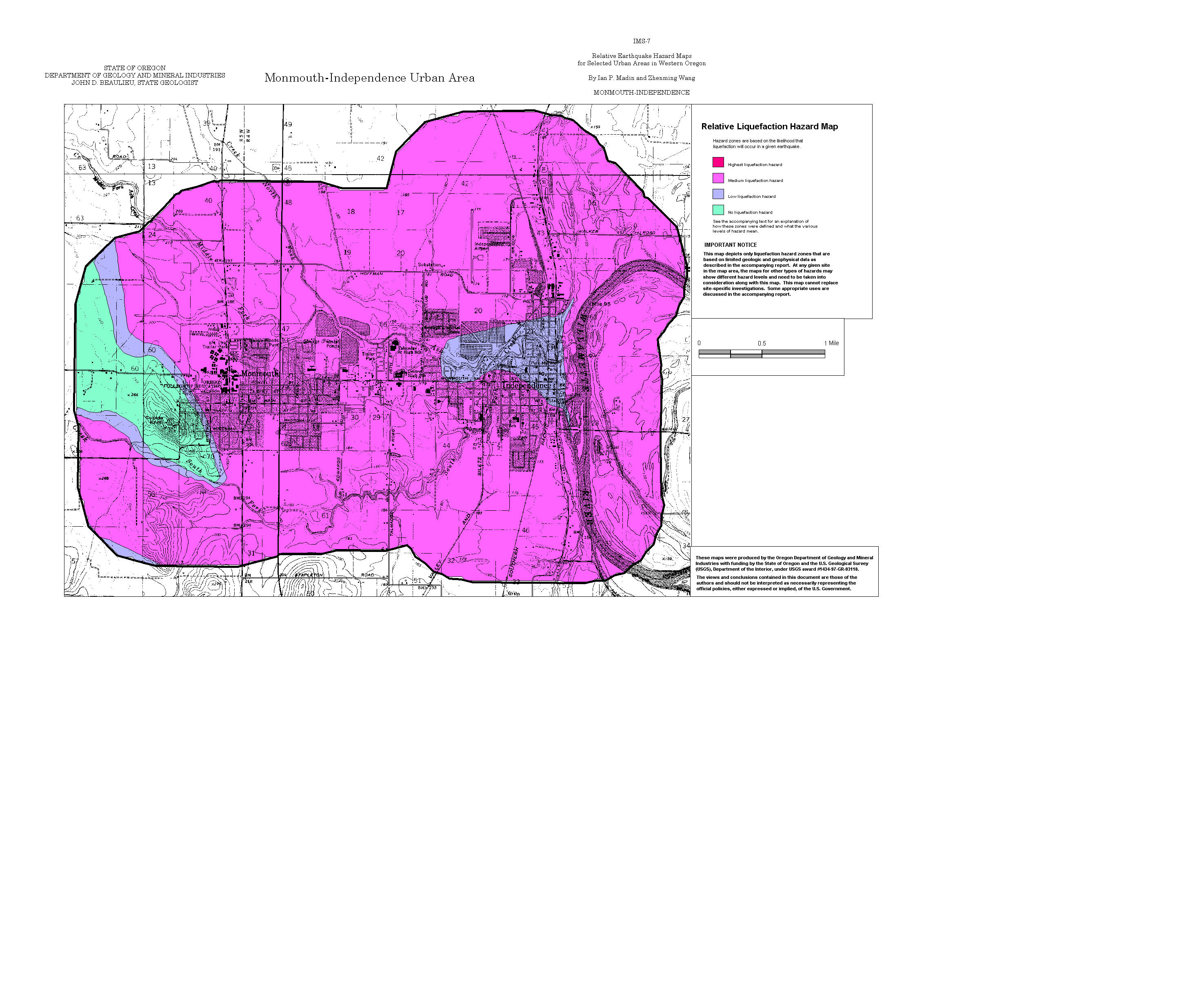
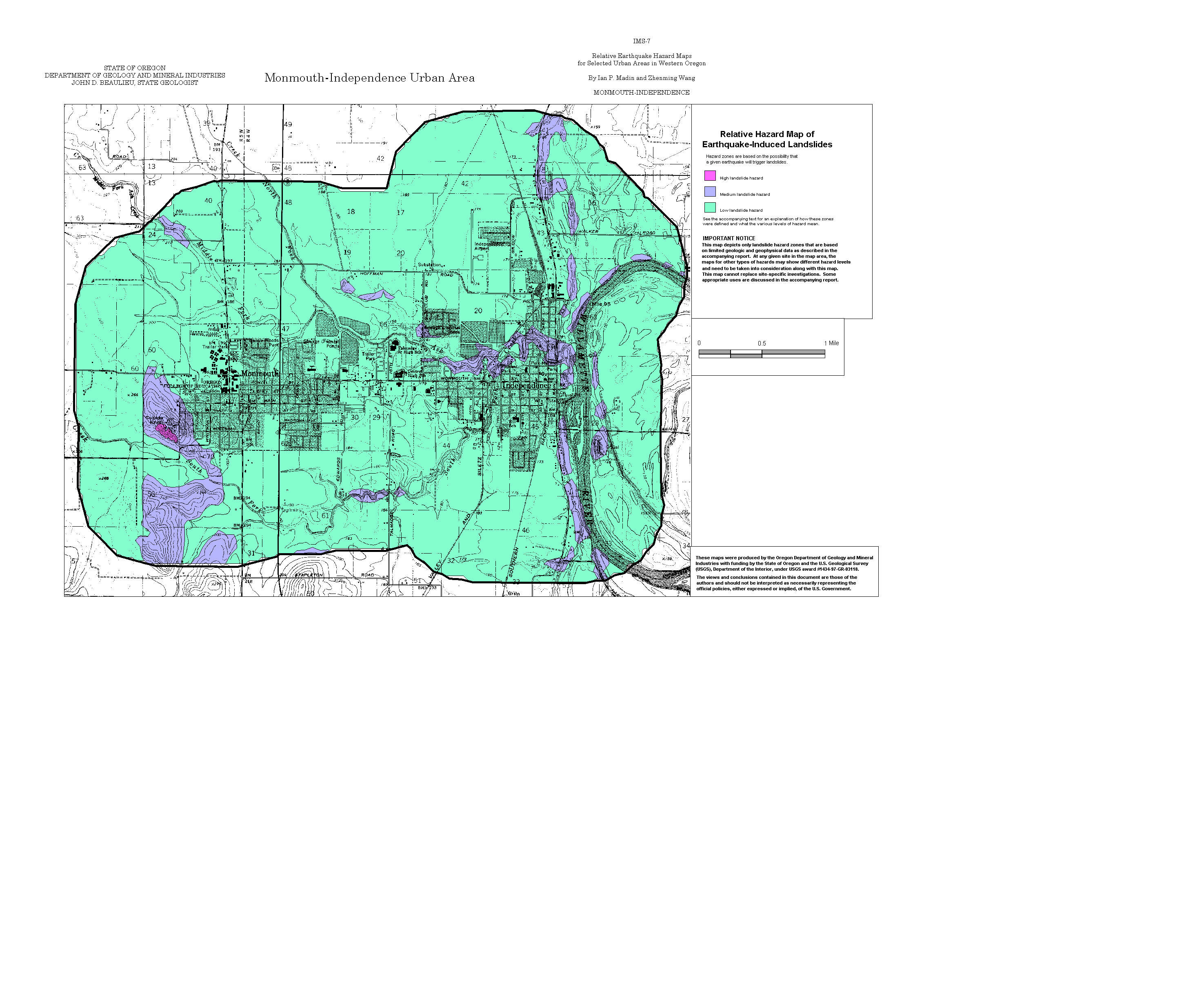
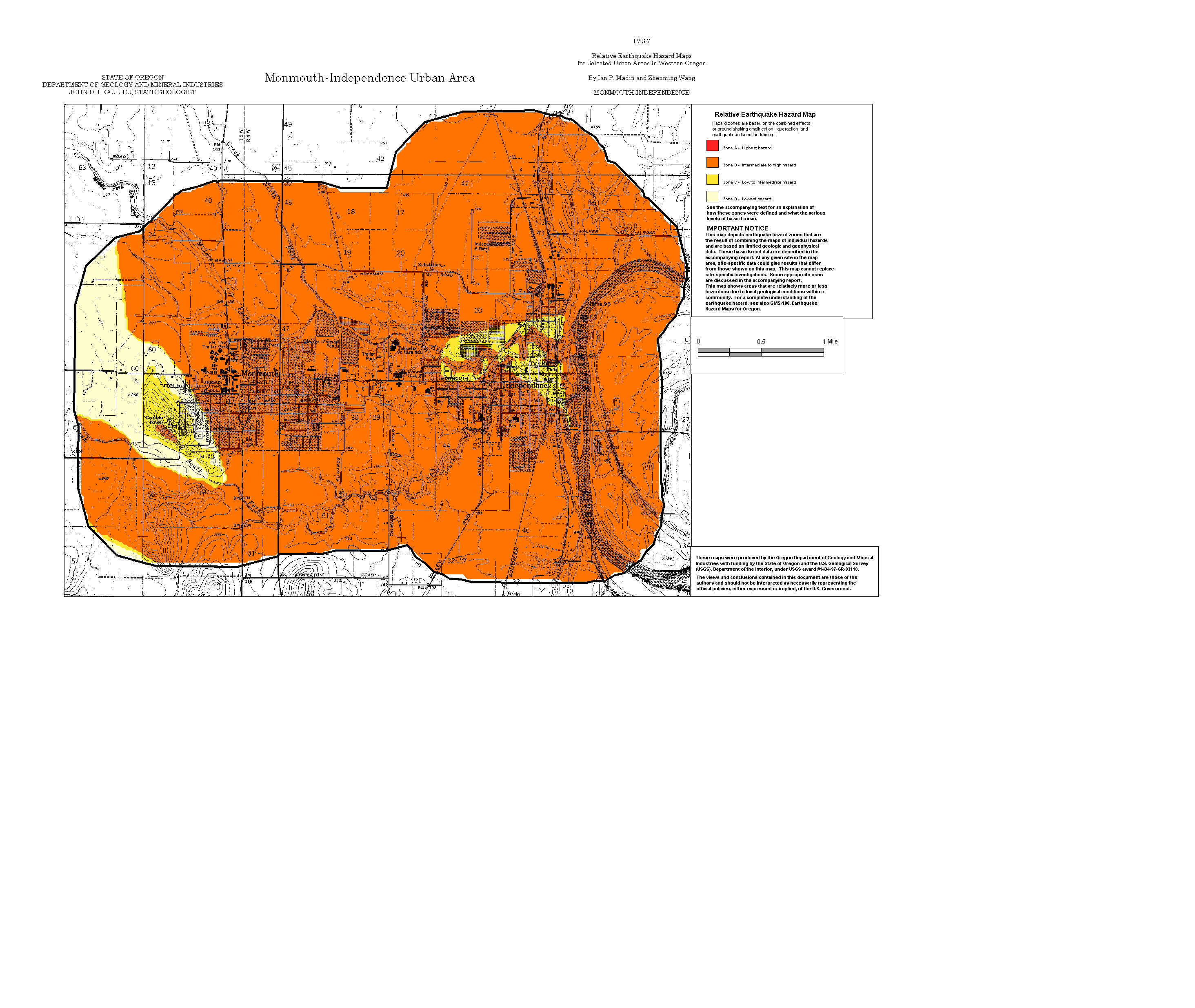
Monmouth-Independence: Amplification, Liquefaction, Landslide, Relative Hazard
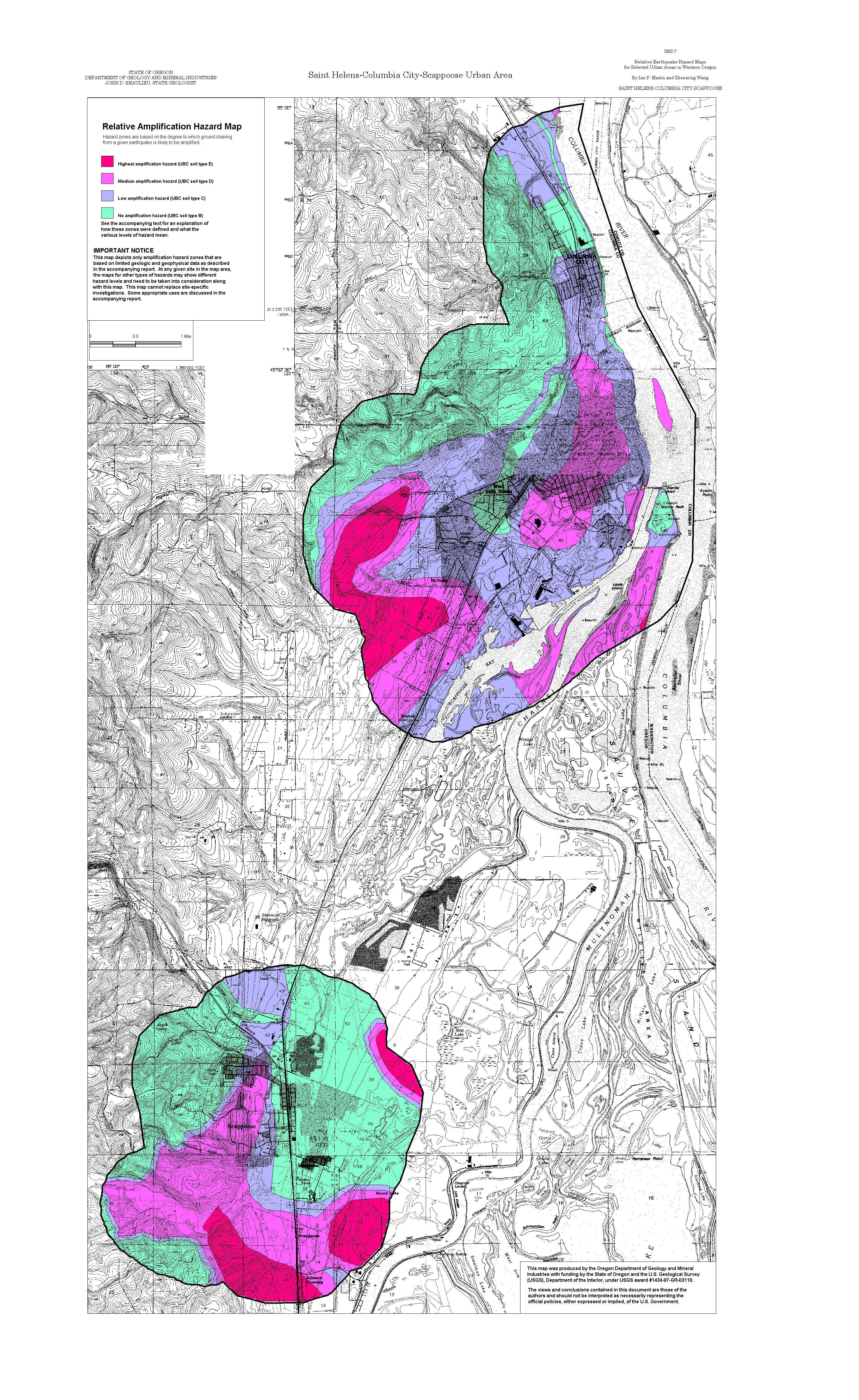
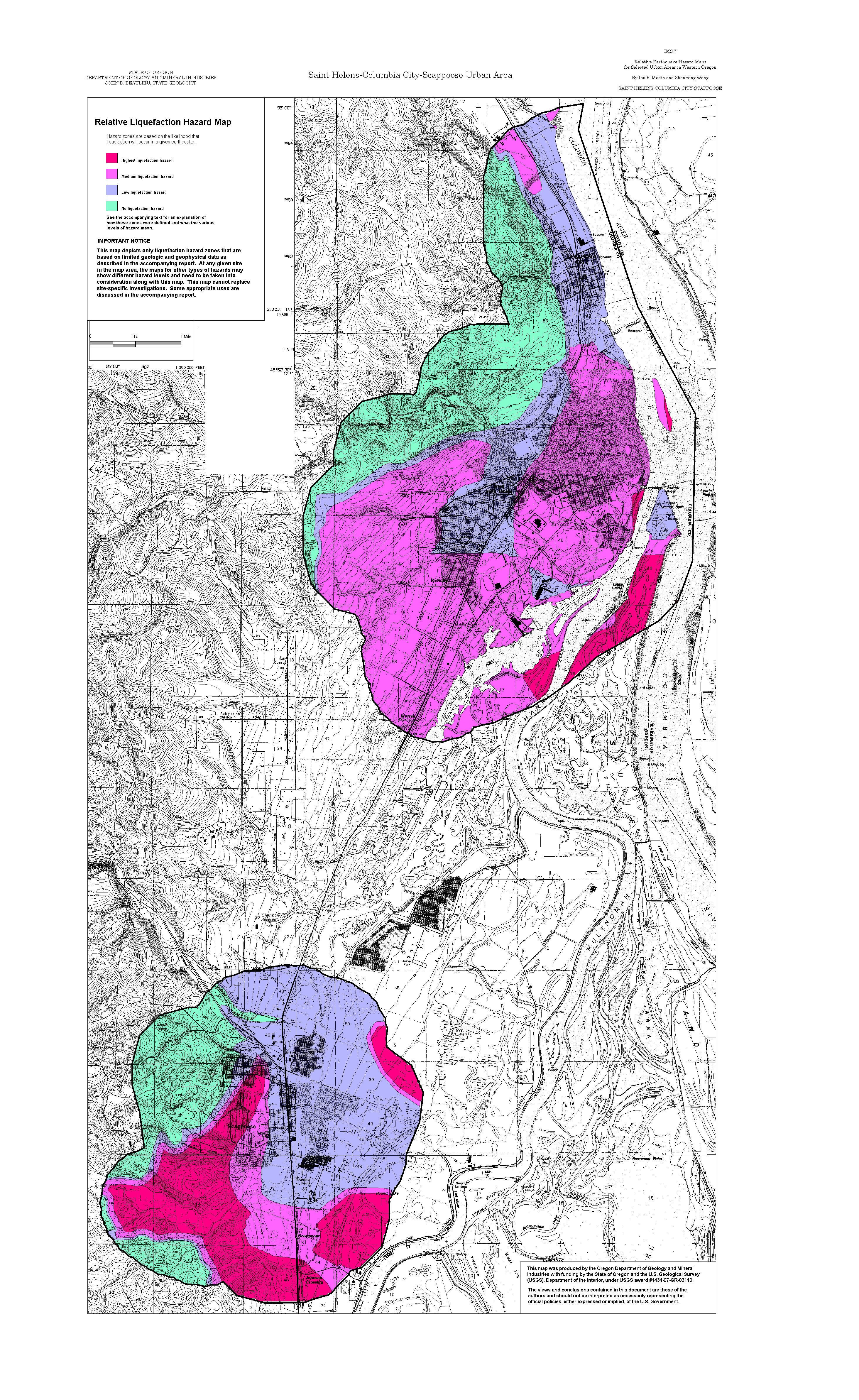
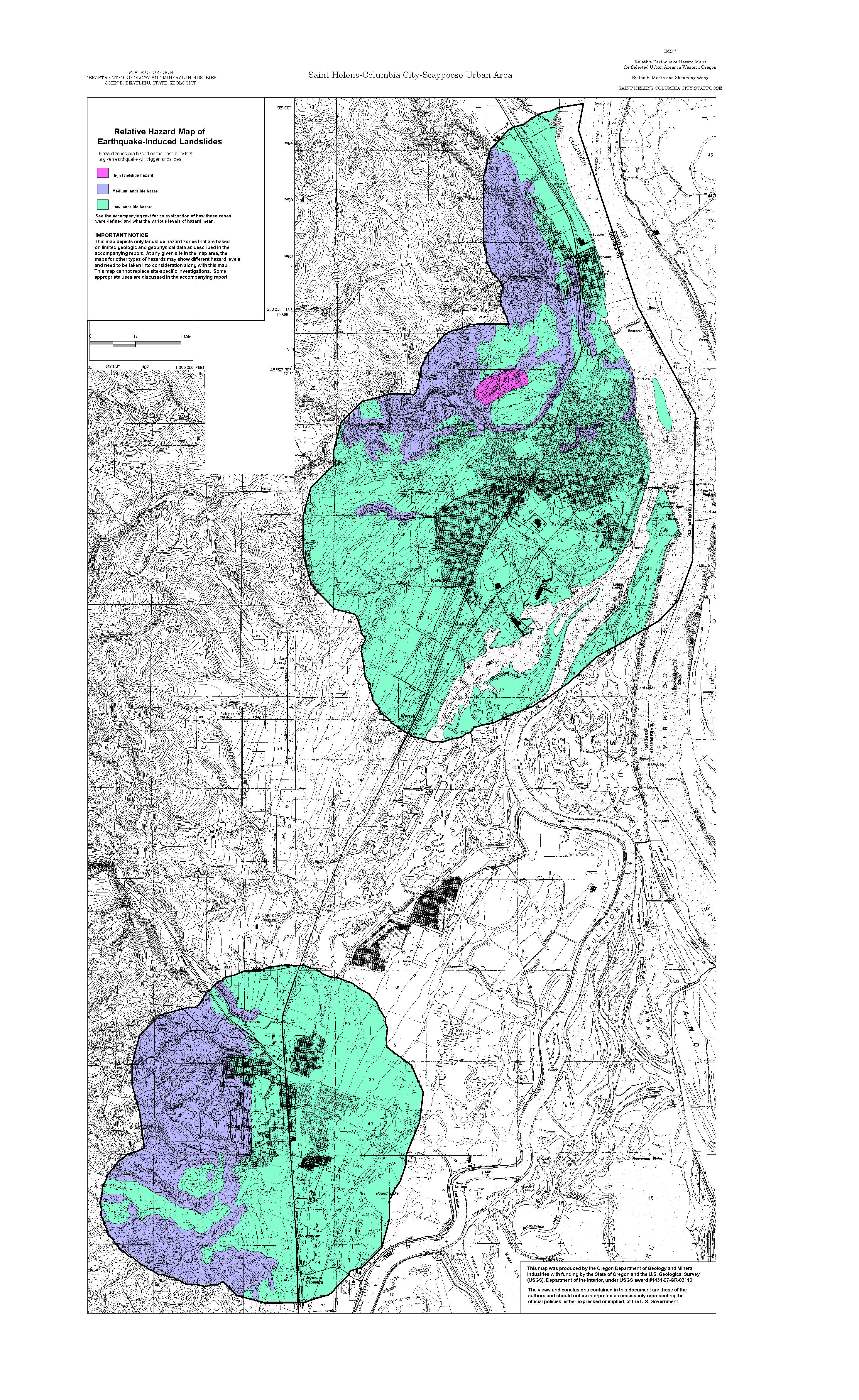
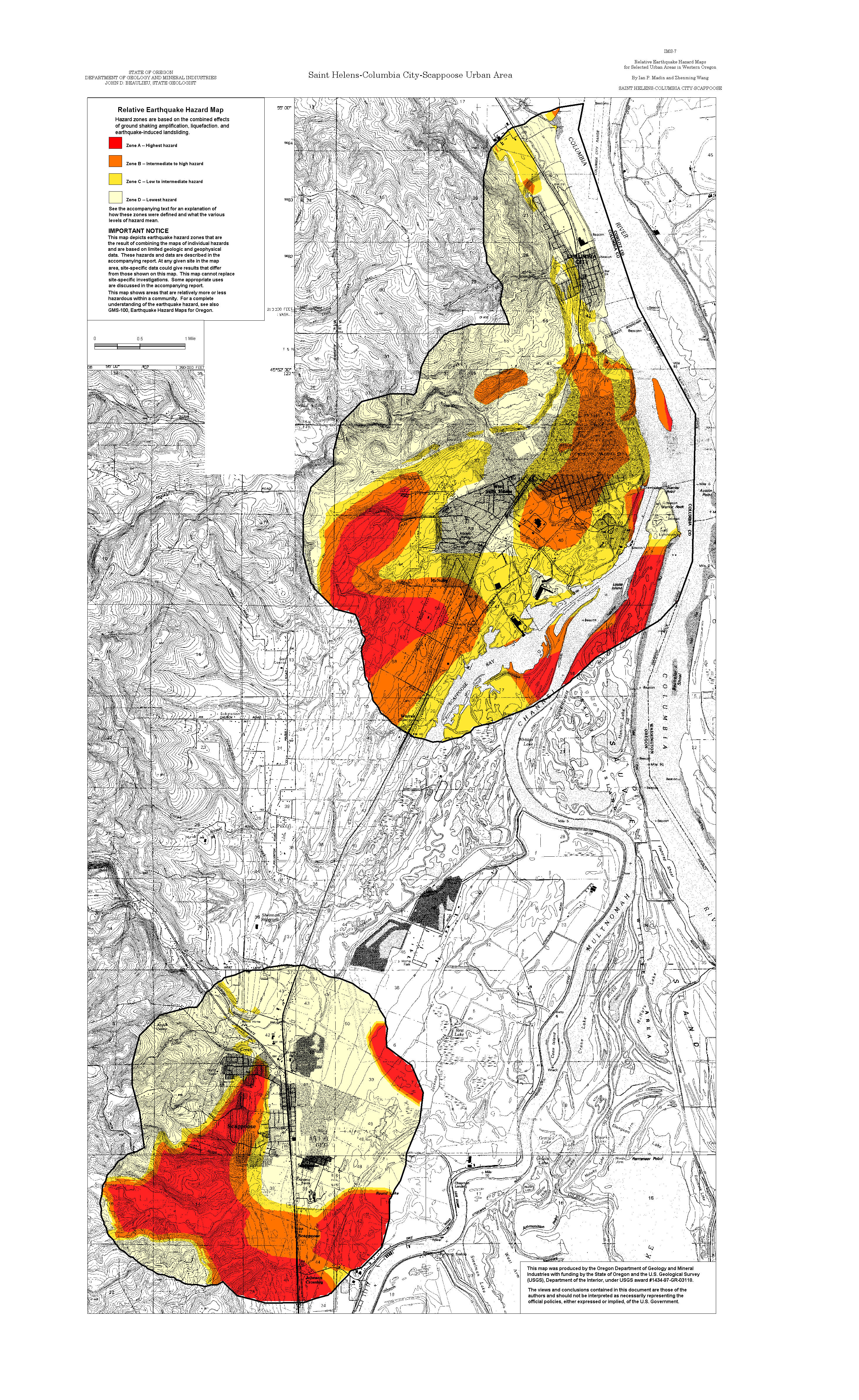
Saint Helens-Columbia City-Scappoose: Amplification, Liquefaction, Landslide, Relative Hazard
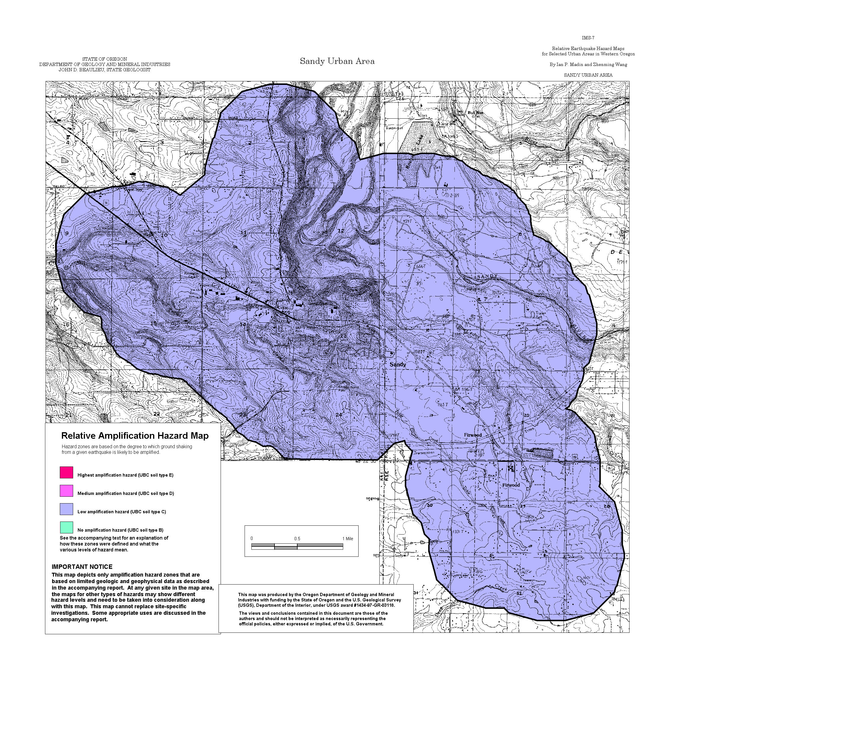
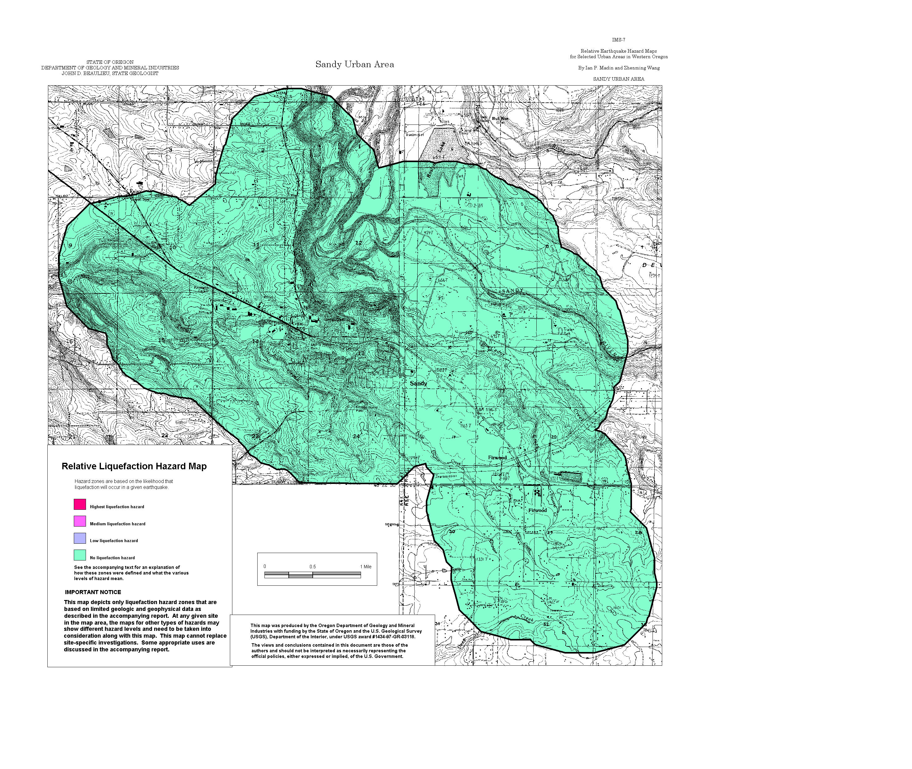
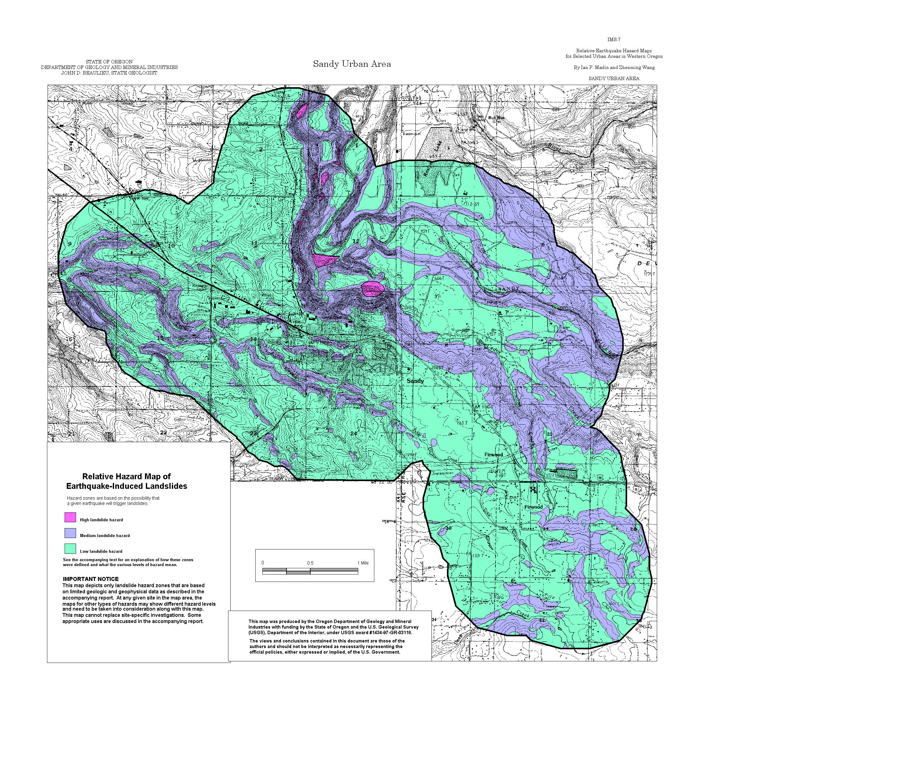
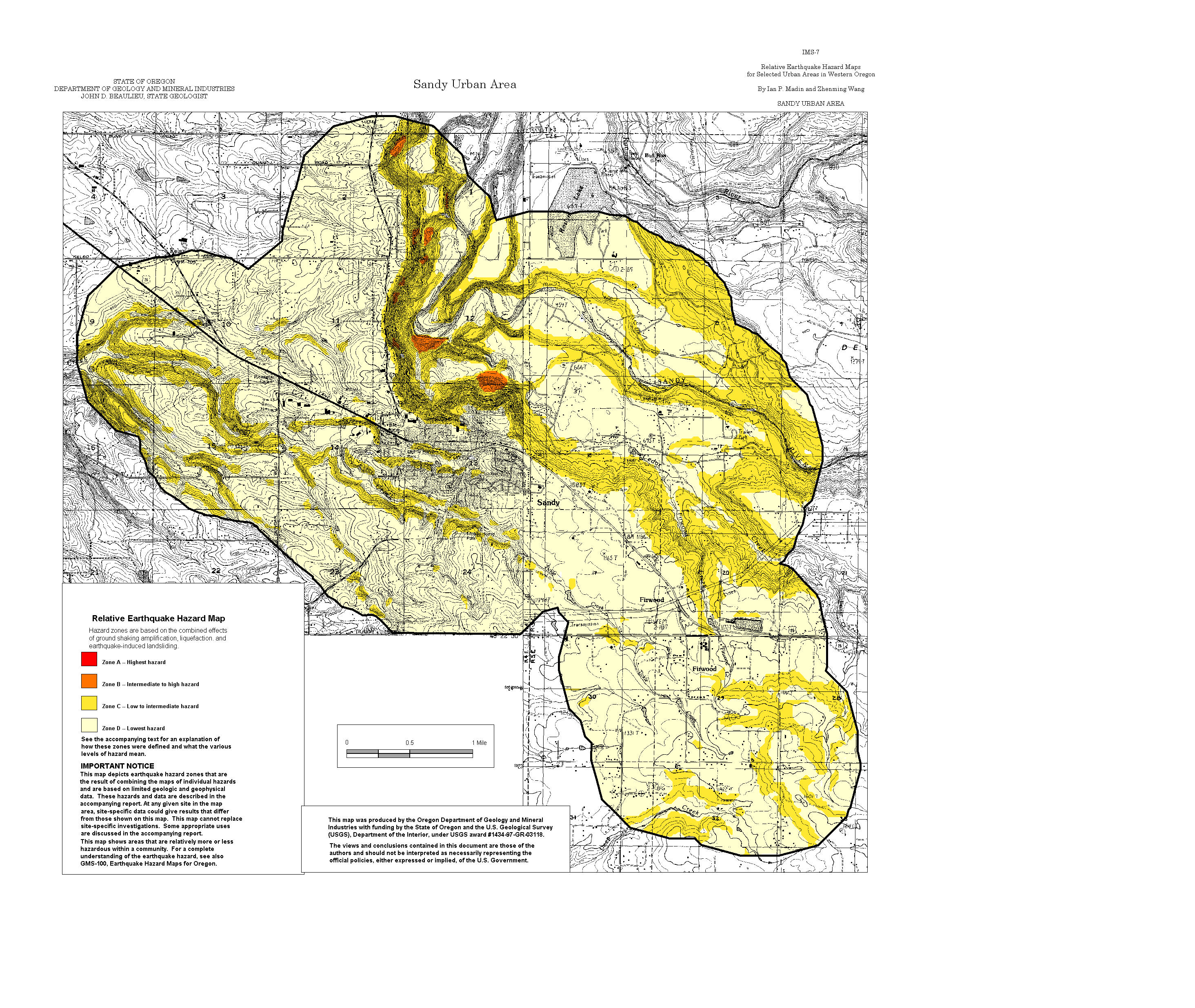
Sandy: Amplification, Liquefaction, Landslide, Relative Hazard
ArcView GIS files (zipped)
MapInfo GIS files (zipped)